Lancaster Canal – into the unknown

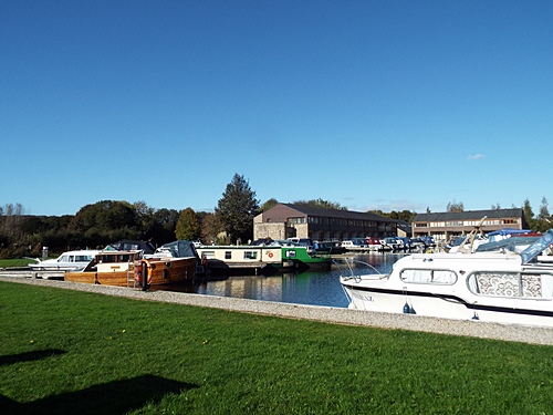
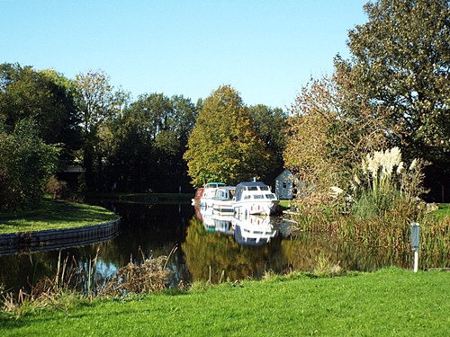
Tewitfield Marina just north of Carnforth lies at the end of the navigable length of the Lancaster Canal and after doing a there-and-back walk south from there in mid August last year I decided I wasn’t going to explore any further north until maybe sometime this year, however a glorious day in mid October was just too good to waste so off I went, arriving at the marina at lunchtime.
DSCF8994 - CopyDSCF8995 - Copy
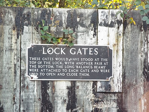
After carrying its final commercial traffic during the 1940s the canal north of Tewitfield subsequently fell into a gradual decline and in 1953 the Docks and Inland Waterways Executive decided to close the 14-mile stretch between there and the canal’s end at Kendal. During the next ten years around five miles of waterway between the hamlet of Stainton and Kendal Canal Head were drained due to leakage, the last two miles in Kendal itself were completely filled in and all the lock gates at Tewitfield were removed to be replaced by concrete sills acting as weirs, with the locks themselves eventually becoming Grade II listed in 1983.
When the Ministry of Transport were developing plans in 1965 for the construction of the Lancaster-Penrith section of the motorway, which was completed in 1970, they weren’t prepared to finance the construction of bridges where the route would cross the canal. After a failed local campaign for the bridges to be built, which would have enabled the eventual restoration of the Northern Reaches, the canal was culverted at the three locations where the motorway crossed it and at three more locations, including Tewitfield, where other roads were re-routed as part of the construction, thus making the waterway north of Tewitfield completely non-navigable. 
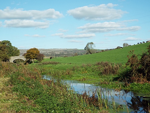
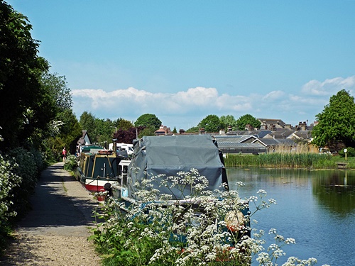
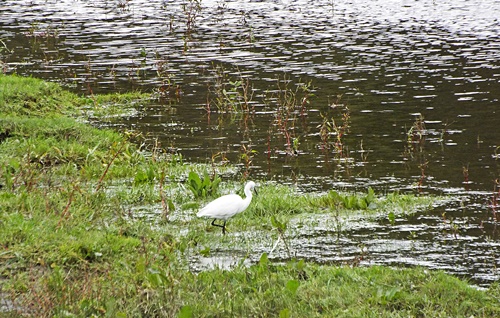
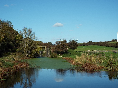
The path from the marina car park took me across the end of the navigable canal and under the A6070 to where the non-navigable length of the waterway began and within a hundred yards or so I came to the first of the eight disused Tewitfield locks, the only ones on the whole length of the canal between Preston and Kendal. Close to that first lock large areas of duckweed covered the canal’s surface and across the far side I spotted a heron perched on top of an old farm gate.
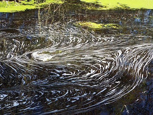
A distance further on the surface of the water was covered in something completely different – it wasn’t oil and I couldn’t tell what it was or where it was coming from but the patterns it made reminded me of those drawn in the froth on cups of coffee in cafes which are pretending to be a bit upmarket. Set at the side of the path close to the last lock were two huge lock gates minus their balance beams, and not far from there the canal came to a dead end, culverted where it was bisected by the M6.

DSCF8997 - CopyDSCF8999 - CopyDSCF9002 - CopyDSCF9004 - CopyDSCF9005 - CopyDSCF9007 - CopyDSCF9011 - CopyDSCF9009 - CopyDSCF9013 - CopyDSCF9012 - CopyDSCF9014 - Copy

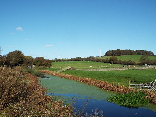
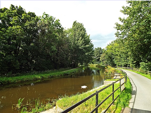
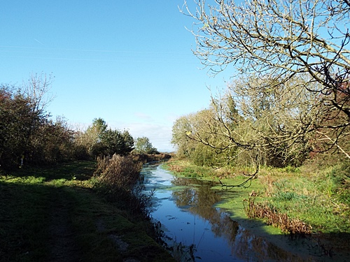
Just before the dead end the footpath veered away from the water to a lane which took me across the motorway and a short distance down to where the canal continued, and as I reached the next section I found that I’d walked out of Lancashire and was now in Cumbria. The first section of the canal had been very noisy as the M6 ran close to it, separated only by a line of trees, but this second section veered away from the motorway and it wasn’t long before the traffic noise disappeared and countryside peace and quiet reigned.

DSCF9016 - CopyDSCF9017 - CopyDSCF9018 - Copy

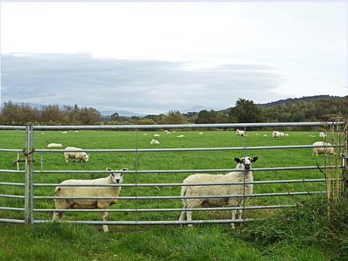
In contrast to the previous section of the canal this part was a bit overgrown in a few places and it was a while before the landscape became more open. Across the far side of the canal sloping fields were dotted with sheep and cattle while gaps in the trees and hedges on the left gave me views over to the distant areas around Warton Crag; other than a few random farm buildings across the fields there was no sign of any civilisation and I saw no-one.

DSCF9019 - CopyDSCF9021 - CopyDSCF9024 - CopyDSCF9025 - Copy

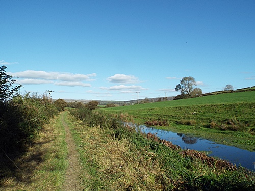
Just over three miles from Tewitfield Marina I reached Bridge 147 and decided to make that my turn around point; it was far enough to go, especially as we had to walk the same distance back again. Back on the noisier section of the canal, across the water between locks three and two, was a small paddock where a few llamas, alpacas and some small sheep were grazing, and close to the water’s edge was another heron – or it could possibly have been the one I’d seen earlier.

DSCF9023 - CopyDSCF9026 - CopyDSCF9027 - CopyDSCF9030 - Copy

Across from the first lock a couple of paddocks were set up with what seemed to be dog agility equipment and in a dip in the land just above the canal bank was a peculiar-looking creature with long spiral horns which, if I’ve got the correct information, was apparently a Hungarian Racka sheep – pronounced rat-ska. In an attractively overgrown corner White Beck flowed into the canal near the A6070 and walking under the road I was back at the marina where I walked round and took my final two shots before heading for home.
DSCF9032 - CopyDSCF9034 - CopyDSCF9037 - CopyDSCF8996 - CopyDSCF8993 - Copy
Since walking this section of canal I’ve discovered via Google maps somewhere not far from my turn-around point where I should be able to park. A rough calculation tells me it’s around five-and-a-half miles from there to where the canal now ends and though I probably won’t do the whole distance at once I’m looking forward to walking at least one part of it later on this year.

Leeds/Liverpool Canal – Leigh branch

After most of July and August were cloudy, wet and miserable the first weekend of this month signalled the start of a mini heatwave so on the Sunday I took advantage of it and went for a walk along a new-to-me section of the Leeds/Liverpool canal. The Leigh branch of the canal runs for 7.5 miles from the main line at Wigan to the edge of Leigh town centre where it joins the Stretford and Leigh branch of the Bridgewater Canal, and my walk started on the western outskirts of the town at Westleigh.
Parking at the end of a dead-end street close to the A579 a path took me through a small wooded area to the canal; turning left would take me towards the town so I went right and headed into what was obviously a more rural area. Past the back of the local cricket club and a large area of open scrubland all went well until I ran out of path and I was faced with walking several yards along the narrow stone canal edge just a few feet above the water. Just ahead was a footbridge which would take me across to the proper towpath so with Snowy in front and Poppie behind I managed to safely negotiate the narrow bit.

DSCF8440 - CopyDSCF8441 - CopyDSCF8442 - CopyDSCF8445 - CopyDSCF8446 - CopyDSCF8447 - CopyDSCF8448 - Copy

The next problem came at the bridge itself. The steps were steep and the walkway was narrow with open railings – Poppie doesn’t cope too well with stairs now she’s older and there was no way all three of us would get across without at least one of us ending up in the canal so I needed a plan. Fastening Snowy to the railings at ground level I carried Poppie across and fastened her up at the far side then went back for Snowy – and by the time I’d gone up, over and down three times I didn’t need to attend a step aerobics class.

DSCF8450 - CopyDSCF8451 - CopyDSCF8452 - CopyDSCF8453 - Copy

The towpath, part of the Greenheart Jubilee Way, was wide and level and with one or two narrowboats moored here and there and the occasional one passing by it made a very pleasant walk. A distance along and set back off the path were two huge old lock gates standing on their ends but there was nothing to explain their significance, though I’ve since found out what they are supposed to be. Apparently the ‘sculpture’, if you can call it that as there’s nothing sculpted about it, was done by Leyland-based Thompson Dagnall and is supposed to represent a book whose pages unlock the stories of the canals.

DSCF8454 - CopyDSCF8456 - CopyDSCF8458 - CopyDSCF8461 - Copy

Eventually I came to Pennington Marina and its waterside development of modern townhouses and apartments. With 40 berths for narrowboats and canal cruisers the marina, opened in July 2012 by the Duke of Gloucester, was developed on land which had been part of the old Bickershaw Colliery. The first pit was sunk in 1877 and at its peak a network of caverns stretched for miles underground to link with two neighbouring collieries. Bickershaw was the largest and deepest coal mine in the Wigan Coalfield and the last working pit until its closure in 1992 when it left behind the largest expanse of derelict land in the Wigan area. Over the years since then much of that land has been reclaimed and now forms part of a network of countryside recreational spaces, wetlands and wildlife sites.

DSCF8462 - CopyDSCF8463 - Copy

Looking west from the marina lift bridge

DSCF8465 - Copy

Walking round the marina I came to the Bickershaw Colliery disaster memorial commissioned by Taylor Wimpey Homes and created by North West sculptor Colin Spofforth. On the morning of October 10th 1932 twenty miners were being lowered in a cage down shaft No.3 to the pit face but during the descent an equipment malfunction caused the cage to be lowered too far. It was submerged into a flooded chamber at the base of the shaft and as a result nineteen of the miners, the youngest only 20 years old, tragically drowned with only one surviving; set in the flagged walkway a few feet from the memorial is a steel plate bearing the names and ages of those who died.

DSCF8468 - CopyDSCF8471 - Copy

I wonder how many dogs can read this

DSCF8474 - CopyDSCF8476 - Copy

With the marina as my turn around point I headed back along the canal and set beside the section of path overlooking Pennington Flash were two massive viewing platforms joined together with steps in the centre. Pennington Flash is a 170-acre lake originally formed in the early 20th century due to coal mining subsidence and flooding – during the 1960s and 70s the idea to convert the area for recreational use emerged and Wigan Council officially opened it as a country park in 1981. Fast forward through the years and in 2022 Natural England declared the area a National Nature Reserve. The viewing platforms, installed in 2012 to coincide with the opening of the marina, were created by Wigan company Versa Ltd in conjunction with Groundwork (North West) and the names etched on the sides belong to Groundwork employees.

DSCF8477 - CopyDSCF8478 - CopyDSCF8460 - CopyDSCF8479 - CopyDSCF8480 - CopyDSCF8494 - CopyDSCF8486 - CopyDSCF8484 - CopyDSCF8485 - Copy

Overlooking Pennington Flash

DSCF8481 - CopyDSCF8489 - CopyDSCF8491 - CopyDSCF8492 - Copy

Almost back to civilisation
Close to where I started the walk was another narrow bridge with steep steps. It would take me back across the canal but I didn’t really fancy repeating the dog-carrying process, however I found a path through a wooded area which took me up onto the nearby main road and from there it was a relatively short walk back to where I’d left the van. This had been my first time walking along that section of canal and I was very pleasantly surprised at how nice it was – definitely a walk to be repeated sometime in the future though next time I’ll make sure I start on the proper towpath.

Lancaster Canal – Tewitfield Marina to Kellet Lane

Just a week after my day out round the Heysham area last month I took myself off north of Carnforth to Tewitfield Marina with the intention of doing a backwards canal walk. Tewitfield Marina is the farthest point at which the Lancaster Canal is continuously navigable and though I would normally have started from the turn-around point of the previous walk there was nowhere convenient to park nearby so it made sense to drive up to the marina, park there and do the walk in reverse.
The afternoon had started with lovely sunshine but it wasn’t to last – grey clouds started gathering and by the time I was a little over halfway to the turn-around point it was obvious that rain wasn’t far away so I abandoned the rest of the walk and headed back to the marina. The wet stuff arrived before I got there, just spits and spots to start with, but by the time I reached the van it was raining properly. With no sign of it clearing there was nothing I could do but come home and hope I could do the walk again another day soon – that turned out to be just three days ago and rather than write two separate posts I’ve combined the photos from both days into one full there-and-back sequence, starting and ending at the very attractive marina with its modern holiday apartments overlooking the water.
DSCF8014 - CopyDSCF8010 - CopyDSCF8007 - CopyDSCF8006 - CopyDSCF8005 - CopyDSCF7717 - CopyDSCF7718 - CopyDSCF8019 - CopyDSCF7720 - Copy
Past a handful of attractive canalside houses and some paddling cows I almost stepped on a small toad sitting in the middle of the path. Up ahead and coming towards me were a family out on a cycle ride so not wanting the toad to get run over I picked it up and put it in the grass out of harm’s way. A short distance ahead the canal crossed over the River Keer and I was opposite the entrance to New England Caravan Park across the canal; I’d been told by someone ages ago that this place had a nice tea room so on both days I stopped off for coffee and cake, and this was where I abandoned my walk on the first day.
DSCF8020 - CopyDSCF8021 - CopyDSCF7724 - CopyDSCF7740 - CopyDSCF8027 - CopyDSCF8024 - CopyDSCF8028 - CopyDSCF7728 - Copy
Entrance drive to New England Caravan Park
DSCF8002 - CopyDSCF7730 - Copy
Continuing the walk on the second day I’d only gone about a mile from the caravan park when I came to my turn-around point, Bridge 130 which took Kellet Lane over the canal. This was where, back in May, I saw several goats and chickens in a garden and though I went to look there were none to be seen this time. A second bridge nearby took the lane over the railway line from Carnforth to somewhere eastwards and with one quick shot I headed back in the direction of the marina.
DSCF7982 - CopyDSCF7997 - CopyDSCF7988 - CopyDSCF7987 - CopyDSCF7983 - CopyDSCF8029 - CopyDSCF8030 - CopyDSCF8031 - CopyDSCF8026 - CopyDSCF8022 - CopyDSCF7989 - CopyDSCF7985 - CopyDSCF7742 - CopyDSCF7744 - CopyDSCF7749 - CopyDSCF7748 - CopyDSCF8016 - Copy
The end of navigation
The drive from home to Tewitfield three days ago had taken longer than anticipated due to a delay on the motorway, however the return journey was thankfully delay-free and the early evening sun stayed with me all the way back, a perfect ending what had turned out to be a really nice afternoon – and after all that walking the three of us certainly slept well that night.

Clifton Marina and the Wet Earth Colliery

A warm sunny day last week saw me out on what was originally supposed to be just a circuit of Clifton Marina, not far from a section of the former Manchester/Bolton/Bury canal which I walked along a few weeks ago, but having recently learned something of the history of the wider area it turned into a bit of an exploration.
Clifton Country Park is a 119-acre nature reserve created on the site of the old Wet Earth Colliery situated between the River Irwell and the Manchester to Preston railway line at Clifton and featuring woodlands, fields, the lake, and various remains of the old colliery hidden among the trees. The Marina – a bit of a misnomer as there are no boats on the lake – was developed from a gravel pit excavated during the 1960s construction of a section of the M62 (amalgamated into the M60 Manchester Outer Ring Road in 1998) and stocked with several different species of freshwater fish it’s very popular with anglers.
Parking on the road running past the Ringley water treatment plant a gravel path took me past a couple of fields to a bridge over the River Irwell and into an area of woodland. A sandy beach on the bend of the river has long been a popular spot for summer picnics but its attractiveness hides a danger – even in summer the river is fairly deep with a strong undercurrent and three years ago a 14-year old boy tragically drowned there after jumping in from the cliff on the far side. The access gate to the beach has been chained and locked since then and several notices around the area warn of the danger but people still climb over and go down there.
DSCF7412 - CopyDSCF7413 - CopyDSCF7130 - CopyDSCF7415 - Copy
Paths through the woodland went left and right so armed with a quickly written list of things to find I took the left and followed the dried up course of a small feeder stream which had once been part of the Wet Earth Colliery. Now very overgrown with trees and various other forms of vegetation along its length that’s where I saw the first of many squirrels.
DSCF7378 - CopyDSCF7139 - Copy
The Wet Earth Colliery has a unique place in British coal mining history as apart from being the first deep cast coal mine in the Irwell Valley it’s also the place where engineer James Brindley made water run uphill. The colliery began in 1750 when John Heathcote, owner of the Clifton Estate, sank a shaft into pre-existing mine workings but he ran into technical difficulties and had to call on the help of local mining engineer Jacob Fletcher, assisted by his then 19-year old son Matthew.
A new shaft, which became known as the Gal Pit after the Galloway ponies traditionally used in mines, was sunk to a depth of 158 feet but the workings were plagued with water which constantly seeped from the River Irwell via the fractured rock of the Pendleton Fault in the river bed. Attempts to solve the flooding problem were unsuccessful and after only two years the pit was closed, however it was soon to be brought to the attention of relatively unknown engineer James Brindley, whose later engineering feats included the Bridgewater Canal and the Trent and Mersey Canal.
With the pithead around 20 feet above river level and no flowing water to power a pump Brindley built a weir upstream at Ringley to create a head of water higher than the pithead then devised a series of shafts and tunnels to create an inverted syphon under the river. Regulated by sluice gates water from the river at the weir flowed through the system into the feeder stream then 235 yards into the pumping chamber next to the pithead where it turned a 23-foot diameter waterwheel which powered a ‘nodding donkey’ – this in turn pumped water out of the mine, with the water going out through another tunnel and back into the Irwell. Construction of the system started in 1752 and the scheme was completed by 1756; the new water management system was very successful and soon after its implementation the Fletcher family took over control of the mine from the Heathcotes, paying them a percentage of the profits each year.
The filled in shaft of the Gal Pit
”Galloway Pony” life-size sculpture by Stephen Charnock, 2008 – ponies like this were used to winch coal up the shaft from the mine
DSCF7402 - Copy
The wheel chamber
”Collier and Pit Brow Lass” by Stephen Charnock – pit brow lasses were surface labourers who worked at the shaft top
Remains of the boiler house
Between 1791 and 1808 the Manchester, Bolton & Bury canal was constructed, with Matthew Fletcher being technical advisor and principal engineer. At the same time he excavated a smaller canal which ran parallel to the river and into a specially constructed loading basin at Gal Pit; the far end joined the Manchester/Bolton/Bury canal at Clifton Aqueduct one-and-a-half miles away and from 1800 loaded coal boats were able to go direct from the mine into Salford and Manchester.
”Starvationer Boat” sculpture by Stephen Charnock – these coal boats were given that name because of their narrowness and visible ribs
The next major phase in the colliery’s life came in 1805 when a second shaft was sunk by Matthew’s nephew Ellis Fletcher and a steam winding engine was installed. The boilers were situated close to the Gal Pit with two long flues connecting them to a tall chimney on the hillside above the mine but as the number of boilers increased a second chimney was built. The original chimney was reduced in height for safety and became a redundant folly – situated close to the railway line I’ve seen it many times on my journeys to and from Manchester and often wondered what it was.
Fletcher’s Folly, the redundant chimney
DSCF7390 - Copy
After Matthew Fletcher’s death in 1808 and Ellis’s death in 1834 Clifton Estate and the pit passed through several members of the Fletcher family in quick succession. A third deep shaft was completed during the 1860s, originally being used as a furnace ventilation pit, but this wasn’t without its dangers. In May 1874 Thomas Entwistle discovered an air blockage in the shaft following which an explosion occurred and he was badly burnt. William and John Ivill (father and son) went to his aid but while descending the shaft they were overcome by blackdamp and fell 300 feet from the cage to their deaths. A serious fire continued to burn for several days afterwards.
By 1880 the coal seams had been almost worked out and production was low; the Fletchers lost all interest and sold the colliery to the Pilkington brothers who later founded the Pilkington Tile Company in 1892 on a site adjacent to Fletcher’s Canal and not far from the Gal Pit. The Pilkingtons undertook a programme of expansion at the pit and the shaft sunk by Ellis Fletcher in 1805 was deepened to 607 feet to reach another coal seam, while much of the surface equipment was replaced. In 1898 a fan house was built by mining engineers Walker Brothers of Wigan and a steam powered fan was installed to ventilate the colliery; output under the Pilkingtons doubled but by 1917 many of the seams had been exhausted.
After the 1921 miners’ strike only one coal seam was being worked and the colliery was gradually run down until it finally closed in 1928. By the start of WW2 most of the buildings had been demolished and the surface features filled in; the land was eventually graded and trees were planted by the Coal Authority. After the lake was created in the 1960s there was much interest in developing the site as an area of recreation; it took a while but by the early 1990s the country park had been established, becoming a designated local nature reserve in 2005.
Scattered remains of the fan house
DSCF7407 - CopyDSCF7408 - Copy
Remains of the colliery railway engine shed
DSCF7384 - Copy
Remains of a worker’s cottage built from stone with a brick extension
This was once the main road to the colliery
”Dig” – a seating and performance area created by Rosie Leventon
I didn’t see everything on my list as some parts of the old colliery were quite overgrown but I only missed a couple of things so satisfied with what I’d found I headed through the main meadow to do my originally intended anti-clockwise circuit of the lake. I hadn’t gone far when I came across the wooden sculpture of a cute fox sitting just off the path – I didn’t know it at the time but this was part of a Fairytale Trail of ten sculptures situated all round the lake. Created by Cheshire-based chain saw artist Mike Burgess and installed by Salford City Council workers and Salford Volunteer Rangers they were funded by pushing up recycling rates in the local community.
DSCF7410 - CopyDSCF7418 - CopyDSCF7142 - Copy
Next I came to The Lookout, created by Tim Norris and Craig Ormerod in 2003; built into the bank of the lake it gives a good view across the water. A bit further along was a viewing platform where I saw a couple of young coots in the water and yet another squirrel, and close by was a grassy area where two geese were chilling out in the sunshine with the Gruffalo and a bear standing a little way along the path.
DSCF7134 - CopyDSCF7135 - CopyDSCF7417 - CopyDSCF7151 - CopyDSCF7419 - CopyDSCF7422 - CopyDSCF7159 - CopyDSCF7160 - CopyDSCF7423 - CopyDSCF7162 - Copy-horz
The path went on for quite a distance before an offshoot took me round the narrow end of the lake, though with the far side not being quite as open the views across the water were few. I did find some more sculptures as I went along though plus a very odd brick-built structure with a flat concrete roof, partially built into the top of the bank. It was possible to go down inside it (it didn’t look very pretty so I didn’t) and differing information says it’s either a bird hide or an air raid shelter, however down the far side of the bank was the dried-up course of the old colliery feeder stream so maybe it’s something connected to that.
DSCF7426 - CopyDSCF7164 - Copy-horzDSCF7169 - Copy-horzDSCF7174 - CopyDSCF7373 - CopyDSCF7428 - Copy-horzDSCF7172 - Copy-horzDSCF7427 - Copy
As I rounded the wider end of the lake I found the last wood sculpture and a narrow path through the undergrowth to the waterside; it seemed to be a fishing spot but there was no-one there so with my feet just a couple of inches from getting seriously wet I took my last photo of the day and headed back to where I’d left the van. It had been a good walk round a place with a very interesting history and as there’s far more of the area to explore it should link in nicely with a future walk along the Manchester/Bolton/Bury canal.

Lancaster canal – a walk from Bolton-le-Sands

This is a walk I wanted to do on a couple of previous occasions but the weather let me down, however last Saturday was glorious so I didn’t miss the opportunity this time. Parking in a lay-by just out of Bolton-le-Sands village a short path took me up onto the canal close to Bridge 126 where I headed in a vaguely northerly direction with my goal being Carnforth Marina.
DSCF6545 - CopyDSCF6546 - CopyDSCF6547 - CopyDSCF6548 - CopyDSCF6550 - Copy
The marina turned out to be not as far away as I’d first thought and I got there sooner than I expected. It was an attractive place with a petrol station nearby, facilities for boaters, the Canal Turn pub, and several boats moored alongside the towpath. A sign in the pub car park rather amused me – I don’t know if the management would ever actually clamp any cars but the pub was closed anyway.
DSCF6551 - CopyDSCF6552 - CopyDSCF6555 - CopyDSCF6554 - CopyDSCF6556 - Copy
As I’d only walked a mile there was no point going straight back to the van so I decided to carry on walking. After a while I came to a children’s playground separated from the path by a long metal fence then round a couple of bends and across the canal a pony grazed peacefully in an attractive paddock. A handful of boats passed by with their occupants waving or shouting a friendly greeting, pretty cow parsley lined the path and I was surrounded by the gorgeous sweet smell of hawthorn.
DSCF6558 - CopyDSCF6557 - CopyDSCF6559 - CopyDSCF6560 - CopyDSCF6565 - CopyDSCF6585 - CopyDSCF6572 - CopyDSCF6568 - Copy
After a while the trees gave way to more open land where sheep and cattle grazed and across the fields to the west I could see Warton Crag hillside in the distance. Passing under the busy M6 I eventually came to Bridge 130 and having walked just short of three miles I decided to make that my turn around point, though first I wanted to see what the view was like from the top. With nothing but fields stretching into the distance there was no sign of any civilisation but just along the lane and almost hidden among the trees was a cottage where several goats and chickens wandered freely in what passed for a front garden.
DSCF6574 - CopyDSCF6571 - CopyDSCF6569 - CopyDSCF6575 - CopyDSCF6576 - CopyDSCF6577 - CopyDSCF6578 - CopyDSCF6579 - CopyDSCF6582 - CopyDSCF6583 - Copy
Back at Carnforth Marina a newly arrived narrowboat was approaching the moorings and I spotted a rather cute design on the side of a boat already there. Further along and up ahead I could see some paddling cows although they were out of the water by the time I got there, then close to my starting point I found a mother swan with three babies almost hidden beneath her wings while another little one tagged along behind her.
DSCF6586 - CopyDSCF6587 - CopyDSCF6589 - CopyDSCF6590 - CopyDSCF6592 - CopyDSCF6593 - CopyDSCF6594 - CopyDSCF6597 - CopyDSCF6600 - CopyDSCF6599 - Copy
By the time I got back to the van I’d walked almost six miles. With the blue sky, just enough clouds to make it interesting and a gentle breeze taking some of the heat out of the sun it had been a perfect afternoon and a walk which had been worth waiting for.

A new experience on New Year’s Eve

After a very quiet time over Christmas the day of New Year’s Eve gave me a very new and interesting experience when I went ‘green laning’ in the Yorkshire Dales with my ex-partner’s brother and sister-in-law, Alan and Louise. This was something I’d never heard of until a couple of months ago so when I was recently invited to join them on New Year’s Eve day I didn’t turn down the opportunity to do something different.
Green laning differs from off-roading in that off-roading takes place ~ legally ~ on wholly private land and a vehicle doesn’t always have to be road legal, whereas green laning takes place on unclassified and often unsurfaced roads, byways and tracks which are Public Rights of Way or BOATs – Byways Open to All Traffic – and vehicles have to be completely road legal with all the usual laws of the road applying. The terrain can be rough, rocky and muddy with stream/river crossings and hair-raising bends but also with great views over open countryside.
My day started at 7am when I was picked up at the end of my street and via the M6 and A684 we went through Sedbergh in south Cumbria to the group meeting point in the car park of the Dales Countryside Museum at Hawes, the home of Wensleydale cheese in the Yorkshire Dales. We were first there so we had time for a brew and some toast while we waited for everyone else; it was only a small group, just two other couples plus the guide, Nathan, and his co-driver, and once we were all equipped with 2-way radios we set off at 10am on the first run.
Dales Countryside Museum, Hawes
DSCF5295 - Copy
View from the car park
A short distance out of Hawes we got onto the first rough track which took us across Snaizeholme Fell – I was sitting in the middle of the rear seats so I could take photos through the front windscreen and it wasn’t exactly a smooth ride. It wasn’t too long before we encountered our first obstacle when the track went steeply down to a gully then rose just as steeply up the other side; the gully was full of large rocks and we got momentarily stuck but with a bit of reversing, some wheel spin and lots of acceleration we got out and up the other side.
Snaizeholme Fell
Around the end of Dodd Fell and right along its eastern base a winding lane took us steeply downhill past the hamlet of Countersett to Semer Water, the second largest natural lake in North Yorkshire. Along the north eastern end is what should be a tree-lined shingle parking area where overnight stays are allowed but the level of the lake had risen so much that it was completely covered by water which was almost up to the road.
DSCF5317 - CopyDSCF5319 - Copy
Semer Water down in the valley
There’s a parking area in there somewhere
Semer Water parking area – what it should look like – photo from Google maps
From Semer Water the lane climbed steadily uphill and eventually we turned off onto a rough track leading round another fell and across a very misty Crag Moor where we got a shout out from the last vehicle – someone needed a quick comfort stop which, being in the middle of nowhere, meant nipping behind the nearest available wall. 
Past a lone farmer in the process of blocking up a large gap in a damaged stone wall the track took us through Carpley Green Farm then downhill to a tarmac lane which led us to the A684 at Bainbridge. From there we drove almost thirteen miles east to the small market town of Leyburn for our lunch stop at 1pm, then with coffee and sandwiches demolished there was just time for me to take a few photos around the market place before setting off on the second run.
Comfort stop on Crag Moor
DSCF5329 - CopyDSCF5331 - Copy
Leyburn market place
DSCF5334 - CopyDSCF5337 - CopyDSCF5338 - Copy
St. Matthew’s Church
This time the route took us around the countryside and moorland to the north of Leyburn and somewhere between Stainton and Downholme we made our first river crossing, then from there we went up through Marske and over Skelton Moor to the second river crossing at Helwith Bridge. 
20221231_135539_resized - Copy20221231_135548_resized - CopyDSCF5347 - CopyDSCF5356 - Copy
Holgate Beck at Helwith Bridge
DSCF5362 - CopyDSCF5363 - Copy20221231_143231_resized - Copy20221231_143244_resized - CopyDSCF5368 - Copy
It was clean when we started
A short drive up and across another area of moorland and a rough track took us down to where we could cross back over Holgate Beck – and that’s where things became decidedly dodgy. At the entrance to an isolated farm was a notice – DO NOT FOLLOW SATNAV, THIS ROUTE IS UNSUITABLE, YOU WILL GET STUCK – and as we got towards the bottom of the track a call came over the radio that the track at the far side of the river was steep, extremely muddy, and had a tight bend with some rocks right on the corner.
Down at the riverside we were given the option of carrying on or turning back and rejoining the trail by another route but we all decided to carry on and we would go first, though Louise (probably wisely) stayed by the river to get some photos. We got through the water with no problem but the tight bend was a different matter; to avoid the rocks there was very little room to get round and there was also a steep unfenced drop down the hillside. It didn’t exactly fill me with joy but Alan is a very experienced driver so I had to put my trust in him and hope we made it without mishap.
With a fair amount of slipping and lurching about we got round in one piece and accelerated safely right to the top of the hill, where Louise eventually joined us after walking all the way up with Nathan who had stayed behind to make sure everyone got safely round the bend and up to the top.
DSCF5371 - Copy
View of the steep track and dodgy bend
Discussing who went across first – it was us
DSCF5379 - Copy
Halfway across
20221231_145101_resized - Copy
The rocks on the bend – more of an obstacle than they look
20221231_150429_resized - Copy
A short drive along the track took us to a narrow tarmac lane leading past a patchwork of open fields separated by dry stone walls then at the little hamlet of Hurst, which consisted of just two rows of three cottages and a farm, we turned onto Marrick Moor, passing a restored chimney which was once part of the Hurst lead mines. 
A very misty Marrick Moor
Old mine chimney on Marrick Moor
Across the moor the track took us on a rough and rocky descent down the escarpment overlooking the village of Reeth and heading towards the hamlet of Fremington, and we were still quite a distance from the bottom when we came across something we wouldn’t have expected to see in such a quiet location. Tucked in the angle of a stone wall was a small blue Toyota car plastered with mud and with its wheels embedded in deep ruts. With a non-existent driver’s side window and police tape all round it we could only assume that it had been stolen and abandoned after getting stuck.
Overlooking Reeth – there’s a sheer unfenced drop ahead on the right
20221231_153737_resized - Copy
Heading down to Fremington – photo from Nathan Yeo, tour guide
muddy car - Copy
From Fremington a ‘B’ road took us through the village of Grinton and another area of moorland to the junction with the road leading to Redmire. The daylight was fading rapidly by then and Alan didn’t fancy doing another run in the dark so we decided to split from the group, make our way back to the A684 and head for home.
It was 7pm when I got dropped off at the end of the street, and though I hadn’t done much during the day other than ride around in the back of the Landrover I still felt quite tired. It had been a long day but also a very interesting and enjoyable one; it was a shame that the weather had been so cloudy and misty as the scenery around the Yorkshire Dales would have been lovely but now I’ve had my first taste of green laning I’m looking forward to experiencing another day later in the year and hopefully in much better weather.

Hest Bank canal walk – heading south

Following on from my tour of the Winter Gardens theatre in October and lunch in a nearby cafe I drove the couple of miles north to Hest Bank for another walk along the Lancaster Canal, this time heading south. Unfortunately the weather gods had decided they no longer wanted to play ball – although it had been beautifully sunny with blue sky while I was in the theatre it was now cloudy and dull, not the sort of weather to show the canal at its best and I did consider coming back home, but with the afternoon stretching before me I decided to do the walk anyway.
Parking on the foreshore at Hest Bank, directly in front of me across the grass was a rather cute looking metal shelduck sculpture with an attractive information board at its base. Created by Ulverston-based blacksmith Chris Bramall on behalf of the Morecambe Bay Partnership it’s one of seven unique bird sculptures situated in different locations around the bay, with each one being associated with that particular location.
DSCF4976 - CopyDSCF4977 - CopyDSCF4978 - Copy
Across the nearby level crossing and the main coast road Station Road took me up to Bridge 118 on the canal where I walked north for a hundred yards or so to check out the weird canalside people and their pets which I’d seen on my walk along there a month previously. With a large banner now fastened to the hedge they were definitely ready for Halloween and even their weird pets were dressed for the occasion.
DSCF4979 - CopyDSCF4980 - CopyDSCF4981 - Copy
Retracing my steps I went back to the bridge and headed south with my goal being the Milestone Bridge which carries the relatively new (opened in 2016) dual carriageway over the canal, linking Junction 34 of the M6 with Heysham and its port.
DSCF4982 - CopyDSCF4983 - CopyDSCF4984 - CopyDSCF4985 - CopyDSCF4986 - CopyMilestone bridge
As far as canal walks go there was nothing remarkable about this one though maybe if the earlier sunshine and blue sky had still been around the surroundings would have looked a lot nicer. Reaching my goal of the Milestone Bridge and with no desire to go any farther on such a dull afternoon I turned and headed the almost two miles back to Bridge 118. Having seen no-one at all during the first part of the walk, at one point it was nice to see an approaching narrowboat and as it passed me the guy at the back of it shouted a cheery greeting. Having messed about on boats myself in previous years I’ve always thought boat people are a friendly lot.
DSCF4987 - CopyDSCF4988 - CopyDSCF4989 - CopyDSCF4990 - Copy
Almost back to civilisation I saw just three more people, a couple walking a small dog and a guy sitting on a bench, then no-one else until I got back onto Station Road. Back at the level crossing I found the barriers were down so I crossed the line via the overhead bridge where I took my final shot of the day looking north along the shore to the hills across the bay.
DSCF4991 - CopyDSCF4992 - CopyDSCF4993 - CopyDSCF4994 - CopyDSCF4995 - CopyDSCF4996 - Copy
With hindsight, if I’d known that the afternoon would turn out to be so cloudy I would have booked a later theatre tour and done the walk first while it was sunny but as the saying goes, hindsight’s a wonderful thing. Would I do that walk again? It would be nice to see that section of the canal in better weather so I might be tempted sometime next year.

Sunshine after the rain

A couple of weekends ago a brief break in the interminably wet local weather produced a lovely sunny Sunday so I took advantage of it and went for an afternoon dog walk along a section of the Manchester, Bolton & Bury Canal just a six mile drive from home. Behind a pub on the main road into Radcliffe steps took me down onto the canal path where I turned right and headed in the direction of Bury.
DSCF5075 - CopyDSCF5082 - CopyDSCF5083 - Copy
Away from civilisation ducks, swans, geese and the occasional moorhen inhabited the canal and its banks while open fields were dotted with cows, sheep and the odd pony or two. Apart from the brief sound of an occasional passing tram on the nearby line between Manchester and Bury it was very peaceful and the afternoon was even warm enough for me to dispense with my lightweight tracksuit top.
DSCF5085 - CopyDSCF5084 - CopyDSCF5086 - CopyDSCF5087 - CopyDSCF5113 - CopyDSCF5088 - CopyDSCF5089 - CopyDSCF5090 - CopyDSCF5091 - Copy
Eventually an offshoot from the path took me up onto a lane running above and parallel to the River Irwell and over on my left was the high bank of Elton Reservoir. I would soon be approaching an industrial area on the outskirts of Bury and having cycled along there several years ago I knew there wasn’t much canal left – it had been filled in many years previously – so I followed the lane across the bridge over the canal and up to the reservoir.

The River Irwell – the canal is on the left just off the photo

The reservoir is the home of Elton Sailing Club and there were several boats out on the water so I snapped a couple of photos then set off on a clockwise circuit of the lake. In the far distance beyond the reservoir and high up on the hills above Bleakholt animal sanctuary was Scout Moor windfarm; occupying an area of almost two miles it’s the second largest onshore windfarm in England and the twenty six 60-metre turbines can be seen from south Manchester, around 20 miles away.
DSCF5093 - CopyDSCF5097 - CopyDSCF5099 - Copy
Away from the open reservoir bank the path meandered through trees for quite a distance and after all the rain we had since since before Hallowe’en it was very muddy in places. Fortunately I managed to pick my way round the worst bits though I was glad when I finally got back onto more open land.
When I got to the gates of the sailing club the path became private so I had to continue my walk along the lane behind the clubhouse. Past a farmhouse and its various outbuildings I soon got back to the point where I started my circuit of the reservoir so I made my way back over the canal bridge and down to the towpath. The sun was getting low in the sky and most of the canal was in shade by then so there were no more photo stops on my way back to the van.
DSCF5104 - CopyDSCF5106 - CopyDSCF5107 - CopyDSCF5108 - CopyDSCF5109 - CopyDSCF5110 - CopyDSCF5111 - Copy
Since that day two weeks ago this area has been hit by yet more endless rain and dog walks have been kept to short circuits of my local avenues so I’m glad I took advantage of that one sunny day. It had been a very enjoyable walk and one I will no doubt repeat in much better weather.

Same walk, different weather

Following my visits to Gresgarth Hall garden in August and October, on both occasions I made the short drive along the road to Bull Beck picnic site where I parked up and went for a walk along a section of the River Lune, an area I first visited two years ago. There were two big differences in each of these two walks though. In August it had been a very hot day, I knew that dogs weren’t allowed in the garden at Gresgarth Hall and as I couldn’t have safely left them in the van they had to stay at home, however October was much cooler and being able to park in shade meant that this time they were included in my day out.
The weather was the second big difference. An almost cloudless blue sky and wall-to-wall sunshine in August but in October, in spite of it being beautifully sunny while I was looking round Gresgarth Hall garden, by the time I’d had a picnic in the van the day had turned cloudy and really dull. I almost decided against doing the walk but it was the dogs’ day out as much as mine so off we went, hoping that it wouldn’t decide to rain while we were a long way from the van. Apart from doing a slight detour in August both walks are the same and many of the photos were taken from the same places along the way so I’ve combined them all into this one post.
DSCF5214 - CopyDSCF4736 - CopyDSCF4737 - CopyDSCF4107 - CopyDSCF4738 - CopyDSCF4108 - CopyDSCF4740 - CopyDSCF4109 - CopyDSCF4742 - CopyDSCF4110 - CopyDSCF4743 - CopyDSCF4111 - CopyDSCF4744 - CopyDSCF4115 - CopyDSCF4746 - CopyDSCF4116 - CopyDSCF4117 - CopyDSCF4118 - CopyDSCF4747 - CopyDSCF4119 - Copy
Since my walk round there two years ago I’d discovered that it’s possible to cross the Waterworks bridge which carries three huge pipes taking water from Thirlmere in Cumbria down to the Manchester area, so in August I decided to make a detour and go across but I was soon to wish I hadn’t. At the far side of the bridge a path led through a pleasant meadow to an area of woodland and that’s where things became a bit difficult. The woodland traversed a steep bank which fell directly down to the river, the path was very narrow in places with partially embedded tree roots just waiting to trip me up and several parts of it had crumbled away leaving very little between me and the steep drop down to the water. Even without the dogs negotiating that lot wasn’t easy but I finally emerged from the trees unscathed and back on level ground by the riverside.
DSCF4120 - CopyDSCF4123 - CopyDSCF4121 - CopyDSCF4124 - Copy
On my October walk I bypassed the Waterworks bridge and as I got near to where Artle Beck flows into the Lune I spotted a Little Egret stalking around in the shallows, presumably looking for his lunch, then across the beck and a bit farther on I came to the Caton Flow Measurement Station, a small square building set on top of a round concrete pillar and looking rather like a tree house but without the tree.
DSCF4750 - CopyDSCF4751 - CopyDSCF4754 - CopyDSCF4755 - CopyDSCF4756 - CopyDSCF4758 - CopyDSCF4761 - CopyDSCF4760 - CopyDSCF4762 - CopyDSCF4125 - CopyDSCF4126 - CopyDSCF4763 - Copy
In August my walk had taken me to the far end of the pedestrian bridge close to the Crook O’Lune picnic site while my October walk took me under the bridge and up the riverbank to the opposite end though I did walk a little way back along the bridge for a shot of the river to contrast with the August photos from the same spot. From the bridge it was a mile-and-a-half straight path back to the van and I’d just got back there when it started to rain so I’d completed the walk just in time.
DSCF4129 - CopyDSCF4764 - CopyDSCF4766 - CopyDSCF4131 - CopyDSCF4132 - CopyDSCF4765 - CopyDSCF4133 - CopyDSCF4769 - CopyDSCF4135 - CopyDSCF4771 - Copy
The rain didn’t last long though, by the time I’d got back on the M6 it had stopped and a few miles further south the sky gradually cleared. Tired out from their long walk Snowy and Poppie were so quiet in their transport kennels I almost had to check that I hadn’t left them behind at the picnic site. Although the afternoon had been cloudy and grey my walk had been much more enjoyable with the dogs than my August walk had been without them, and with the sky becoming increasingly brighter on the drive back home our day out ended as it began, in bright autumn sunshine.

Overnight at Glasson Dock – 2

Quite surprisingly, in spite of spending the night in the van alone in a strange place, I’d slept soundly all the way through and woke to early morning sunshine and the promise of another lovely day, and looking across the estuary I could see that the tide was in. A quick comfort break for the dogs, toast and a mug of tea for breakfast and I was ready for the first walk of the day, the reverse of the previous day’s walk but with a slight variation which would bypass the village instead of going through it and past the marina.
DSCF3767 - Copy
Looking south westwards from the top of the lane where I was parked I could see Cockersand Abbey with Blackpool Tower in the distance around twenty miles away. The original Cockersand Abbey was founded in 1180 as the Hospital of St. Mary-on-the-Marsh then was refounded as a Premonstratensian priory in 1190, and though it continued as a hospital it was elevated to abbey status in 1192. It was the third richest abbey in Lancashire when it was dissolved in 1539, then in 1544 the building and surrounding land were acquired by a John Kitchen, subsequently passing into the Dalton family in 1556 when Robert Dalton married Ann Kitchen, John’s daughter.
While some scrappy remains of the abbey still stand to this day the Grade l vaulted octagonal Chapter House is the only significant relic still intact. Built around 1230 and eventually used as a family mausoleum by the Daltons during the 18th and 19th centuries it’s now classified as a scheduled ancient monument and opened to the public on special occasions such as Heritage Open Days.
Heading along the road towards the canal I saw a sign on a gate for ‘alpaca experiences’ at a nearby farm and in the adjacent field four woolly creatures with cute faces were looking inquisitively at me from behind a fence. It was only when I looked at the photo on my pc later on that I realised there was a hare loping along in the background – it can just be seen in the centre right of the shot.
DSCF3774 - Copy
Along the road towards Conder Green the high tide had filled all the creeks and channels of the saltmarsh and boats which I’d seen beached on the mudbanks the previous day were now floating gently at the end of their mooring ropes, although there was one boat which had obviously seen better days as it was partially submerged in the River Conder. The Stork pub was looking very attractive as it was now in full sunshine, and walking along the estuary footpath/cycleway I spotted a heron at the water’s edge.
DSCF3785 - CopyDSCF3799 - CopyDSCF3801 - CopyDSCF3803 - CopyDSCF3807 - CopyDSCF3806 - CopyDSCF3811 - CopyDSCF3810 - CopyDSCF3808 - Copy (2)DSCF3812 - CopyDSCF3813 - CopyDSCF3814 - Copy
Back in the village the Lock Keeper’s Rest was open and there was already quite a gathering of bikers enjoying breakfast in the sunshine. Crossing the green near the dock I stopped to photograph the picture boards outside the shop then my thoughts turned to treating myself later on to lunch at the Dalton Arms – that was until I saw the not-exactly-cheap menu outside. The prices were ridiculous so that idea was soon dismissed – if I really wanted something later it would be cheap and cheerful down at the Lock Keeper’s Rest.
DSCF3840 - CopyDSCF3842 - CopyDSCF3844 - CopyDSCF3845 - CopyDSCF3848 - CopyDSCF3846 - CopyDSCF1788
Back at the van I made another brew and contemplated what to do with the rest of the day. Glasson may be a nice little place with lovely scenery but ‘little’ is the operative word – it’s very small, and there’s only so many photos I can take and canal walks I can do without repeating myself so I got the last few shots from the end of the lay-by then took myself off to the big car boot sale at St. Michael’s, a 20-minute drive away.
DSCF3823 - CopyDSCF3830 - CopyDSCF3838 - Copy
With the weather being so nice the car boot was packed with both sellers and bargain hunters but in spite of there being so many stalls I didn’t see anything I really wanted to buy so I treated myself to a double 99 from the ice cream van then drove a short distance back along the road to Guy’s Thatched Hamlet at the side of the Lancaster Canal. It’s a quaint and quirky little place which I’ve been to a few times in recent years and you can read about its history here.
DSCF3849 - CopyDSCF3850 - Copy
Having parked in the hamlet itself I walked up onto the lane and crossed the bridge to the main A6 road. A little way along was Old Duncombe House, a cottage-style B&B in what is believed to be a building dating back to the 16th century, and with its white walls, hanging baskets and colourful planters it looked very attractive in the sunshine. Walking up as far as the short lane to the next bridge I crossed back over the canal and headed along the towpath back to Guy’s, then even though it was still only the middle of the afternoon I decided to head back home from there.
DSCF3852 - CopyDSCF3853 - CopyDSCF3857 - CopyDSCF3859 - CopyDSCF3860 - CopyDSCF3861 - Copy
As far as completely off-grid camping experiences go my overnight stay at Glasson Dock had been a good one and in spite of being on my own in a very quiet location I hadn’t felt apprehensive or unsafe at all. Since that weekend I’ve found details of a circular walk which takes in Cockersand Abbey, a place I’d like to take a proper look at, so maybe next summer I’ll return to Glasson for another overnight stay – it’s certainly something to think about.