Boats and butterflies

One day back in March I went to explore a creek on the southern outskirts of Lytham, and though it looked quite an attractive place it was also a very muddy place as it was low tide at the time. Promising myself I would go back one day when it was high tide the opportunity came towards the end of August and I was also able to tie in my visit to the creek with a later walk along part of Lytham beach.
Leaving the van in the quiet lane at the side of the minor creek where I saw the welly boot stuck in the grass back in March I walked along the top of the bank to the main road then along to the creek with all the boats. Negotiating rather a tricky stile the first thing I came to was some sort of pumping station with the water in the creek bubbling like a boiling kettle, but just as I found a good spot to take a photo the bubbling stopped and everything became calm.
DSCF6254 - CopyDSCF6248 - Copy
The creek itself, at high tide, looked much more attractive than it was in March though I couldn’t go as far along as I did back then. The raised bank sloped down at the far end to a large area of flat grassland split by a minor creek, and though everywhere had been bone dry on my previous visit the grass was now very boggy under the surface. And how do I know that? – because my feet sank into it and I got my trainers covered in black mud!
DSCF6245 - CopyDSCF6244 - CopyDSCF6241 - CopyDSCF6238 - Copy
As I’d been walking along I’d noticed several tortoiseshell butterflies flitting about, in fact there weren’t just several there were lots of them and some of them did actually stay still long enough for me to get a few shots of them.
DSCF6234 - CopyDSCF6237 - Copy (2)DSCF6237 - CopyDSCF6258 - CopyDSCF6243 - CopyDSCF6242 - CopyDSCF6240 - CopyDSCF6239 - Copy
Using the longer grass to wipe the worst of the mud off my trainers I went back along the top of the bank and made my way back to the van for the next part of my day. Driving along the seafront I came to Lowther Gardens which was the nearest place to where I wanted to be so I left the van there and later walked a short distance along the road, crossing over to a short slipway onto the beach. Through reading someone else’s blog I’d recently found out about a short stretch of the beach where I could find some old boats and even older tractors and on such a lovely sunny day they were a photo opportunity not to be missed.
DSCF6595 - CopyDSCF6596 - CopyDSCF6600 - CopyDSCF6602 - Copy
Farther along the beach and close to the low water line was the Celestial Dawn, a 41ft ketch which ran aground in August 2019. Two sailors, along with some equipment and personal items, were rescued by the Lytham inshore lifeboat but with a sixteen inch hole in its hull the Celestial Dawn has lain on the beach ever since, being enveloped by the tide twice a day so only the masts are visible. 
DSCF6616 - CopyDSCF6618 - CopyDSCF6611 - Copy
Heading back to the tractors I came across an upturned dinghy buried in a water filled hole in the marshy grass; any deeper and it would have looked like a boat shaped coffin. Back at the slipway I took my last few shots of the boats and tractors, most of which were obviously past their best, then went back to collect the van from Lowther Gardens car park and head for home.
DSCF6619 - CopyDSCF6606 - CopyDSCF6597 - CopyDSCF6599 - CopyDSCF6601 - Copy
It had been a lovely day, the weather had been perfect, and it had been good to find the boats and tractors which I hadn’t previously known were there. There’s actually a third part to this particular day too but the photos I took really deserve a post of their own so I’ll save those for a Monday walk another time.


Remembering Sophie

It was eleven years ago today that Sophie came into my life. I’d found her from a classified ad on the internet while searching for a companion for my other little dog Sugar and of all the Jack Russells advertised something kept drawing me back to her picture. It seemed I was the first person to ring and enquire about her; she lived in south Derbyshire and as I couldn’t drive at the time a good friend offered to take me down there to see her the following day.
When we pulled up outside the house Sophie was in the garden with Christina, her owner, and the minute I saw that little dog something grabbed me and I just knew I was bringing her home. The following day was Sophie’s birthday, she would be two years old, so it seemed that not only was I getting a new little friend and Sugar was getting a new companion but Sophie was also getting a new home for her birthday.
She curled up on the back seat of my friend’s car and slept all the way back, and from the minute we arrived home it was as if she had always been there. She settled in with Sugar straight away, often sharing the same bed, she liked running about and exploring while on our long walks and quickly grew to love our many camping adventures. She only ever barked briefly if someone came to the door, other than that she was very quiet, and she was the happiest, sweetest, gentlest, most good natured little dog I’ve ever known.
Sophie & Tiger 009Sophie On The Beach 003Sophie & Sugar, Christmas 09 012
Photos above : Top – Sophie’s 2nd birthday, 23-09-2009   Centre – Fleetwood beach, 04-10-2009   Bottom – Christmas Day 2009
California - May - June 2010 228
Misc. May-June 2010 043Anglesey - June '10 046
Photos above : Top – Swamped by a wave on a Norfolk beach, 03-06-2010   Centre – With the rosettes she won at a fun dog show, Oswestry 20-06-2010   Bottom – On Cemaes beach, Anglesey, 28-06-2010
Copy of Major Bridge Park - May 2011 047Misc. May-June 2010 019Elvaston Castle - July 2011 088
Photos above : Camping at an East Yorkshire site, May 2011   Centre – Paddling in the River Calder, June 2011   Bottom – Camping at Elvaston Steam Rally, July 2011
Manorafon - April '12 052Manorafon - April '12 057Anglesey - June '12 061
Photos above : Top & centre – Looking abandoned outside a cafe near Abergele, North Wales, Easter 2012   Bottom – With Sugar on the Anglesey camp site, June 2012
Willow Lakes - Feb. 2013 025Willow Lakes - Feb. 2013 030Copy of California - May - June 2010 262
Photos above : Top – Looking very silly in a hoodie far too big for her, Willow Lakes camp site February 2013   Centre – With Sugar on the same site   Bottom – In the van and not happy to be going home, Anglesey June 2013
Anglesey - May 2014 068Copy of Sophie
Photos above : Top – The end of another holiday, Anglesey May 2014   Bottom – At Elvaston Steam Rally July 2014
Sophie had been with me for over five years when just before Christmas 2014 I sadly lost Sugar to kidney failure at the age of sixteen-and-a-half. I’d been aware of the outcome when she first became ill so not wanting Sophie to be on her own I searched the internet again and found Poppie – she lived in Grimsby and I collected her on the last day of October that year. Initially on the timid side she became a good friend to Sophie once Sugar was no longer with us and the two of them were often found sharing the same bed.
Anglesey - June 2015 089Elvaston Castle - July 2015 024California - Sept. 2015 132
Photos above : Top – With Poppie in the tent, Anglesey June 2015   Centre – At Elvaston Steam Rally July 2015   Bottom – On the camp site at California, Norfolk, September 2015
Anglesey - May 2016 121Anglesey - June 2016 047Copy of Sophie & Poppie - little elves 011Copy of Sophie & Poppie - little elves 015
Photos above : Top – Curled up with Poppie, Anglesey May 2016   Centre –  In the tent, Anglesey June 2016   Bottom two – Santa’s little elves, December 2016
Local area 2017 323Copy of Sophie and Poppie 2017 003
Photos above : Top – The deepest she ever went in water, at a local reservoir May 2017   Bottom – After a minor operation on a front leg, June 2017
Copy of Elvaston Castle - July 2013 035DSCF1250
Photos above : Top – The end of an Anglesey camping trip, June 2018   Bottom – After a long local walk, July 2018
Copy of Local area 2019 310Copy of Local area 2019 329DSCF1287
Photos above : Top & centre – A walk in a local park, March 2019   Bottom – With Poppie on holiday in Cumbria, June 2019
I didn’t know it at the time but our Cumbrian holiday in June 2019 would be the last proper holiday Sophie would have. As many of you will remember from previous posts she suffered a stroke in early January this year; with medication and 24/7 care from me she improved slowly and I was hopeful that she would eventually recover but sadly it wasn’t to be and she drifted peacefully away after almost five weeks.
DSCF3795 - CopyDSCF3807 - CopyDSCF3804 - CopyDSCF3816DSCF3811 - Copy
Photos above : Top – Wrapped in a pilchard-stained towel after just being fed   2 – A silly way of sleeping   3 – The best way to keep her safe while I was out of the room   4 – In her bed at the side of mine   Bottom – In the back garden after a walk
Sophie’s passing left a huge hole in my heart, a hole which even now still hasn’t completely healed, and I still have unexpected moments of sadness when something triggers a particular memory of her. Tomorrow would have been her 13th birthday and though she is no longer here Poppie and I will cuddle up, remember the good times, and share a bit of cake in her memory.

In search of Colourfields

Pennine Lancashire’s Panopticons are a unique series of twenty-first century landmarks purposely situated in high-point places which give panoramic views of the surrounding areas and after visiting the Singing Ringing Tree three weeks ago I decided to seek out another of the landmarks. Blackburn’s Corporation Park features Colourfields and as it’s an easy drive from home I went there just a couple of days ago.
The Colourfields landmark sits on the former cannon battery which was originally installed for the park’s opening in 1857 and which housed two Russian cannons captured during the Crimean War. Unfortunately time took its toll over the years and the battery fell into disrepair but the design and construction of Colourfields in 2006 enabled the structure to be preserved rather than demolished, which would otherwise have been necessary owing to its deterioration.
The large park is situated on a very steep hill to the north west of Blackburn town centre and while I realised that Colourfields would more than likely be towards the top end actually finding it wasn’t the easiest task. Numerous paths led to different parts of the park but following various signs didn’t help as they seemed to be sending me in all different directions, and I was just beginning to lose the will to live when I got chatting to a very nice couple who lived locally and were able to tell me where the landmark was and how to get to it.
Unfortunately when I did finally find Colourfields I felt distinctly underwhelmed and disappointed. There was nothing anywhere to say what it actually is, no information board, nothing, and having previously seen photos of it on the internet it was vastly different to what I expected. Any colour had disappeared almost into oblivion, there was a tile missing from one of the steps and some parts of the original coloured floor surface had been replaced at some time with ordinary plain grey tiles. The surrounding railings were nothing to write home about either, they looked just like the ones you find where you cross a road junction with traffic lights – in short, the whole thing just looked incredibly dull.
Internet information says that from the viewpoint you can see over the park down below and the town beyond, and on a clear day there are distant views towards Lytham, Southport and Fleetwood; unfortunately most of the view was obscured by trees and the sun was shining from completely the wrong direction so I didn’t take any photos from there. For the purposes of this post I’ve pinched a couple of shots from the internet just to show what Colourfields should look like but the other four photos are my own.
Colourfields 2ColourfieldsDSCF6803 - CopyDSCF6804 - Copy (2)DSCF6804 - Copy - CopyDSCF6806 - Copy
It’s a shame that Colourfields has lost its colour and is looking a bit worse for wear as it was obviously once quite attractive, but though much of the internet blurb describes it as being ‘dramatic’ and ‘impressive’ I’m afraid my own opinion of it is vastly different. On the other hand, Corporation Park itself is lovely and I got some great photos while I was there so I may very well revisit another time but one thing’s for certain – I won’t be walking all the way up to Colourfields.

Lancaster Canal – Garstang to Catterall

My Monday walk this week is the on-foot version of a cycle ride I did ten years ago. Back then I was camping at Bridge House Marina by the canal on the far side of Garstang so my cycle ride had started from there, however this time my walk was starting from Garstang itself, at Bridge No.62 near Th’Owd Tithe Barn pub/restaurant.
Set back off the canal and next to the restaurant was The Moorings Basin with several colourful narrowboats moored up, then a couple of hundred yards away was the Wyre Aqueduct designed by John Rennie and built in 1797; at 110ft long it carries the canal 34ft above the River Wyre. At the far side of the aqueduct a set of steep wooden steps led down to the riverside where I was able to photograph the structure from down below.
DSCF6263 - CopyDSCF6266 - CopyDSCF6267 - CopyDSCF6268 - Copy
Back up on the canal I passed a long stretch of modern houses and went under three bridges before I left civilisation behind, and apart from the sound of birds in the trees and an occasional passing boat it was very quiet and peaceful. Round a wide bend I could see the old Garstang castle, or what remains of it, standing on high ground in the distance at the far side of the canal; photographing it from nearby is something else on my ever-lengthening ‘to do’ list.
DSCF6269 - CopyDSCF6270 - CopyDSCF6271 - CopyDSCF6273 - Copy
Greenhalgh Castle was built in 1490 by Thomas Stanley, 1st Earl of Derby, and the land on which it was built was said to be a gift to Stanley from his stepson Henry Tudor for his assistance in defeating Richard lll at the Battle of Bosworth. Constructed of rubble and sandstone it stood on a small area of raised ground and was rectangular with towers 24 yards square at each corner.
During the English Civil War the castle was garrisoned by James Stanley, 7th Earl of Derby, in support of Charles l and it was one of the last two Royalist strongholds in Lancashire to succumb following a siege by Cromwell’s forces in 1644/45. The garrison eventually surrendered in 1645 on provision that the men were allowed to return to their homes unharmed, then demolition teams partially destroyed the castle to make sure it couldn’t be used again for military purposes.
After the castle’s destruction many of the local farmhouses, including the nearby Castle Farm, incorporated some of the stones into their buildings; following its continued deterioration over the centuries the only remaining part is the lower section of one of the four original towers and as it stands on private land it’s inaccessible to the public although it can be seen fairly close up from a nearby lane.
DSCF6274 - Copy
Approaching the next bridge I was quite surprised to see a couple of cows across the other side of the canal, standing well over knee deep in the water and slurping copious amounts from between the weeds and water lilies. Eventually I came to a marker post telling me it was 16 miles to Preston – I didn’t think it was as far as that but if it was then I was glad I wasn’t going there.
DSCF6275 - CopyDSCF6277 - CopyDSCF6278 - CopyDSCF6280 - Copy
My goal on this walk was the Calder Aqueduct, again designed by John Rennie and built in 1797 but shorter than the Wyre Aqueduct. Carrying the canal over the River Calder in the Catterall area the aqueduct has an adjoining weir on the upstream side, built to lower the bed of the river under the canal with the river itself being channelled beneath the canal through a single elliptical arch. The riverbank on the downstream side was wide and grassy with a steep path down from the canal and ten years ago I’d stopped there for a picnic before cycling back to the camp site.
DSCF6282 - CopyDSCF6283 - CopyMisc. May-June 2010 021 - CopyMisc. May-June 2010 011 - CopyMisc. May-June 2010 020 - CopyMisc. May-June 2010 016 - CopyMisc. May-June 2010 015 - Copy
Heading back to Garstang I spotted something up ahead on the far side of the canal and getting closer I found it was a heron. It hadn’t been there earlier so I watched for several minutes, and unlike the statue-like one I’d seen on another stretch of the canal back in June this one did actually move. Eventually I came to the marker post which told me it was a mile back to Garstang although to get to there from the town earlier on had seemed to be more than a mile.
DSCF6285 - CopyDSCF6288 - CopyDSCF6292 - CopyDSCF6293 - CopyDSCF6281 - Copy
Approaching civilisation there was a small inset on the far side of the canal with three colourful narrowboats moored up and it wasn’t long before I began to see boats moored on my side. I’ve often wondered where some canal boats get their quirky names from and I couldn’t resist snapping a couple of them. One of the last in the row had some small brightly decorated barrels fastened to its roof and they looked so pretty I thought they deserved to be photographed.
DSCF6296 - CopyDSCF6299 - CopyDSCF6307 - CopyDSCF6301 - CopyDSCF6304 - CopyDSCF6303 - CopyDSCF6302 - CopyDSCF6298 - Copy
Back across the Wyre Aqueduct, past the Moorings Basin and Th’Owd Tithe Barn and I was back at my starting point, Bridge No. 62 where my van was waiting for me just a few yards down the road. The walk was one I’d been wanting to do for a while, I’d really enjoyed revisiting a part of the canal I first went to ten years ago and it was another completed section to tick off my list.

MV Carrier – a ship on the rocks

Situated on the hillside high above the A55 Expressway at Llanddulas, to the north of Colwyn Bay in North Wales, is the limestone-producing Raynes Quarry. Stone from the quarry is transported by conveyor belts crossing above the nearby railway line and under the A55 to Raynes Jetty where it’s loaded into coastal freighters for taking to other parts of the British Isles.
On the evening of Tuesday April 3rd 2012 the Bahamas registered 269ft long cargo ship MV Carrier, having collected about 1,700 tons of limestone from the quarry, was hit by force-9 winds and five-metre swells and ran aground on the rocks and concrete sea defences near the jetty, breaching its hull in three places. In an operation involving two helicopters and two lifeboats launched into a full gale and rough seas all seven uninjured Polish crew were rescued, with police closing a section of the A55 for public safety and to allow the helicopters to land and take off.
A few days later it was the Easter weekend and while camping at a lovely site less than three miles north of Llanddulas I drove down the A55 on a day out from the site. I could see the tops of the ship’s masts as I went past its location but that’s all I could see so I decided that on the way back I would try to find it and get some photos. It wasn’t an easy task as I had to park up and walk quite a distance along the coastal cycle path, also a 100-metre exclusion zone had been placed round the ship’s immediate area and police and officials were everywhere, but by walking up to the top of a steep grassy outcrop and down the far side I managed to bypass the barriers and the blue-and-white ‘Police Crime Scene’ tape and get to a spot where I had a good view of the ship.
After an inspection of the ship and a structural assessment revealed severe damage the German shipping company who owned and managed it declared it ‘a constructive total loss’. Salvage crews were called in to remove 24,000 litres of fuel, work which had already started when I shot my photos, then the Carrier was to be cut up on site into manageable sections which would be taken by road to a designated scrap yard.
Manorafon - April '12 028 - CopyManorafon - April '12 025 - CopyManorafon - April '12 026 - CopyManorafon - April '12 027 - Copy
Keeping off the A55 I headed back to the camp site along a road which took me past Raynes Quarry on the hillside and on the spur of the moment I decided to try and see the Carrier from up above. Unfortunately the roadside wall was too high for me to see over but a short walk through a nearby small housing estate led me to a spot on the hillside almost directly above the ship. My view was partially obscured by the branches of various shrubs and bushes but I was still able to take a reasonable photo. 
Manorafon - April '12 029 - Copy
The fuel removal operation was completed on April 9th and demolition of the ship started immediately afterwards with the work expected to take about six weeks depending on various safety and weather conditions. Unfortunately I was unable to revisit the area for any more photo opportunities so I’ve pinched a couple of superb shots of the Carrier during demolition from https://geotopoi.wordpress.com/ another blog I read.
mv-carrier-20120421-05mv-carrier-20120421-01
Twelve months after the ship’s grounding a critical report by the Marine Accident Investigation Board raised questions about the experience and guidance of the quarry’s jetty operators, adding that staff allowed the Carrier to continue loading in spite of the bad weather conditions. The ship’s owners also criticised the quarry operators for not giving the crew appropriate advice, and following the report the company no longer sends ships to Raynes Jetty.


The Singing Ringing Tree

Standing on the moors high above the Lancashire town of Burnley is the Singing Ringing Tree, a wind powered musical sculpture designed by architects Mike Tonkin and Anna Liu as part of a project for the East Lancashire Environmental Arts Network. Completed in 2006 it’s 10ft tall and built from galvanized steel pipes of varying lengths which form the shape of a tree bent and blown by the wind. 
A total of 322 pieces of steel make up the tree; these are arranged in 21 parallel layers with each layer being supported by rings and everything being welded and bolted together. Although the widest point at the top spans over 13ft the narrowest point at the bottom is less than 4ft wide; computer models were used during the design process to calculate the right amount of rings, bolts and pipes needed to keep the structure upright. Due to the varying length of the pipes and the narrow slits cut into specific ones the tree produces a sound, when the wind blows, which covers several octaves and is described as being discordant, melancholy, and intensely beautiful.
I first found out about the tree quite a while ago but even though it’s only a 35-minute drive from home I’d never managed to get there, however I took advantage of a beautifully sunny early morning just a few days ago and went there straight from work. Just over a mile and a half from the A682 up a steep moorland road I came to a small car park set back off the road itself and I could see the tree down the hill and to the right. A stony path with a left and right turn led from the car park and a ten minute walk got me to the tree.
DSCF6332 - CopyDSCF6320 - Copy
Being still reasonably early in the morning I had the place to myself so I was able to wander round and take photos from several different angles without anyone getting in the way. Although not exceptionally windy there was a stiff breeze blowing which was just enough to make the tree ‘sing’ though to be honest I certainly wouldn’t describe the noise as being ‘intensely beautiful’ – it was weird, slightly eerie, and reminded me of the sound you get when blowing across the top of an open glass bottle.
DSCF6322 - CopyDSCF6321 - CopyDSCF6323 - CopyDSCF6326 - CopyDSCF6329 - CopyDSCF6330 - CopyDSCF6329 - Copy (2)DSCF6224 - CopyDSCF6325 - Copy
When I’d got enough photos of the tree I turned my attention to the surroundings and trying to ignore the urban sprawl of Burnley down in the valley I got a few shots of the countryside and the views towards Pendle Hill before making my way back along the path towards the car park.
DSCF6337 - CopyDSCF6340 - CopyDSCF6343 - CopyDSCF6344 - CopyDSCF6345 - CopyDSCF6346 - Copy
Towards the top of the path and just at the other side of a wire fence was a stone built cairn which, since that morning, has given me several hours of frustration and annoyance. The structure itself looks fairly modern, maybe built from the remains of a stone wall, but I couldn’t decide if the worn stone frescoes round its sides were very old or modern ones maybe done by children and made to look old.
Although there’s an information board near the car park which tells how the area got its name there’s no mention at all of the cairn; Google Maps says it’s a ‘decorated cairn/historical landmark’ and though there are many internet sources of information for the Singing Ringing Tree there’s no information anywhere for the cairn – even a phone call to Burnley Tourist Information produced nothing but a ‘this number is not in use’ message so I’m currently none the wiser as to its history, age or significance.
DSCF6348 - CopyDSCF6211 - Copy
DSCF6354 - CopyDSCF6353 - CopyDSCF6349 - CopyDSCF6352 - CopyDSCF6350 - CopyDSCF6351 - Copy
Not far from the cairn and close to the car park was the very attractive Life for a Life memorial forest planting site established in 2003 and where a native tree can be planted in memory of a loved one. Coming from across the road was the constant bleating of a sheep and when I went to look I saw just one on its own while the other few in the flock were quite a distance away and ignoring it completely. The moorland on that side of the road seemed to be wilder and more desolate and I was glad it was a sunny morning; with one final shot looking down the road I went back to the van and set off for home.
DSCF6356 - CopyDSCF6355 - CopyDSCF6360 - CopyDSCF6364 - CopyDSCF6362 - CopyDSCF6363 - CopyDSCF6365 - Copy
The walk from the car park to the Singing Ringing Tree and back was only a very short one and I’d only spent an hour in the area but in the warm sunshine it had been a very pleasant hour. Although I wouldn’t purposely go back to the tree I know there are a couple of good walks which can be done from there so maybe next year I’ll go back for a revisit.
** The original Singing Ringing Tree, from which the sculpture partly gets its name, was an East German children’s film made in 1957 and shot in Technicolour. It was bought by the BBC in the 1960s and cut into three parts which were shown as a mini series in late November/early December 1964, being repeated many times over the years until 1980. With its style of story telling similar to the Brothers Grimm it was said to be ‘one of the most frightening things ever shown on children’s television’, and a Radio Times readers’ poll in 2004 voted it the 20th spookiest tv show ever.
*** Since writing this post I’ve been given a little information about the cairn. It was built by Alan Rhodes, a dry stone waller from Whitworth, for Mid Pennine Arts in Burnley as part of a celebration for the Singing Ringing Tree – one of their artists worked with local school children and cast the panels which depict the Singing Ringing Tree fairy tale. An internet photo taken in 2011 shows it looking very new so I assume that’s the year it was built.

Queen’s Park squirrels

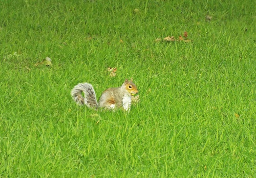
Walking through Queen’s Park the other day I took several photos of the squirrel I saw, a couple of which I included in my previous post, but as he looked so cute I thought he deserved a post of his own. I actually took a photo of another squirrel when I was in the same park last year so I’ve included him too.
Copy of Local area 2019 262DSCF6194 - CopyDSCF6198 - CopyDSCF6202 - CopyDSCF6199 - CopyDSCF6196 - CopyDSCF6195 - CopyDSCF6197 - CopyDSCF6203 - CopyDSCF6204 - CopyDSCF6205 - CopyDSCF6201 - Copy
Although the squirrel I saw last year very quickly scampered up the tree the second one wasn’t in too much of a hurry so I was able to watch him from a respectable distance for several minutes. I know grey squirrels are classed as vermin but to me it doesn’t matter what colour they are, they are all cute and this one certainly was.