The day I took the short train journey to Blackburn to see the Knife Angel was actually my second attempt to go there. I’d originally set out to see it the day before, only to find there were no trains running on Sundays between here and there due to maintenance work on the line, so Plan B came into force. I’d recently found out about some new street art in Manchester’s Northern Quarter and as I hadn’t been there for a while I decided to seek out the artwork while it was still new.
A short walk from Victoria Station I came across a couple of artworks which were so new that the hydraulic platforms used while painting them were still in front of one of them. These particular gable end walls seem to be used specifically for advertising and though I wouldn’t normally photograph adverts I did like these, especially the larger of the two with its creatures and colourful foliage. Not far away was an advert for Dr Martens but the rendered surface of the wall was so rough I had to stand well back to see the detail of the picture properly.
Away from the advertising walls I roamed the NQ’s roads, side streets and back alleyways and though I’d seen quite a lot of the street art before I also found quite a lot which, although not recently new, was certainly new to me. Walls, shutters, window decorations, even a section of road – nothing escaped the camera lens.
In Stevenson Square a section of the road had been painted with a colourful Christmas tree design and only a few days previously street artist Hammo had gone to town on the walls of the old redundant public toilet block, with one side looking like a gingerbread house and the other side complete with a line of dogs with a sleigh full of presents. Unfortunately the whole block was surrounded by steel barrier fencing so I couldn’t get any unobstructed close-up shots without poking the camera lens through a couple of gaps.
Close to Stevenson Square I found a couple of fantasy murals on the windows of a game store and down a narrow side alleyway just off Newton Street I came across a mural by Liverpool-based Brazilian artist Liam Bononi. Liam is well known for the very expressive eyes and hands in his artworks and this one was instantly recognisable before I saw the signature at the bottom. My final shot as I made my way back to the station was one of Akse’s excellent murals, his most recent one and apparently a character from Squid Game, whatever that is.
My last visit to Manchester had been in August (and I still haven’t got round to sorting out the photos I took then) so I could possibly have missed a few artworks between then and now, but finding so many new ones turned what had started out as a disappointing morning into quite a successful one.
After all the grey, damp and drizzly weather we had locally during October and early this month we recently had a couple of really nice sunny days so one morning I took the dogs for a walk round Rivington Terraced Gardens, somewhere I hadn’t been to for quite a while.
In 1899 local soap magnate William Hesketh Lever (Lord Leverhulme), founder of Lever Brothers (now Unilever) and one of Bolton’s most famous and generous benefactors, bought a large parcel of land below Rivington Pike on the western slopes of Winter Hill with ideas on how it might be developed, and in 1901 a single storey prefabricated timber bungalow supplied by a firm in Manchester was erected on a level section of the hillside. Named Roynton Cottage it was designed by Lever’s old school friend Jonathan Simpson and was intended for weekend visits and shooting parties.
Four years later Lever met landscape architect Thomas Mawson and the two collaborated in the design of the terraced gardens though Lever himself influenced the actual layout and also designed Lever Bridge which crossed the main lane through the gardens. With one large arch crossed by six smaller ones it was based on a bridge Lever had seen during a trip to Nigeria and is now known locally as Seven Arch Bridge. Work on the gardens spanned a 16-year period from 1906 and in 1921 the landscape and architectural firm of James Pulham & Son were responsible for the creation of a steep rocky ravine with waterfalls and a Japanese-style garden with three pagodas, inspired by a visit Lever had made to Japan several years earlier.
In 1913 the bungalow was destroyed in an arson attack by suffragette Edith Rigby. The stone-built replacement was on a much grander scale and was a place for entertaining; along with a dining room, morning room, lounge, library, study, kitchen and servants’ quarters it also incorporated a music gallery, a circular ballroom, glass-roofed pergola and a winter garden. Following Lever’s death in 1925 the house and gardens were purchased by Bolton brewer John Magee then after his death in 1939 the site was acquired by Liverpool Corporation; in 1948 the bungalow and its entrance lodges were demolished and the gardens were opened up to the public. Following local government reorganisation in 1974 the site passed to the North West Water Authority and along with much of the surrounding land is now owned by United Utilities.
After decades of nature being allowed to take its course the gardens gradually became overgrown in many places and in 2014 the site was named by the BBC Countryfile programme as one of Britain’s Best Lost Gardens. In early 2016 the Rivington Heritage Trust secured £3.4million from the Heritage Lottery fund to improve, revitalise and maintain the gardens and their features and a huge repair and conservation project was soon undertaken. With non-native shrubs and self-seeded trees being cleared away, remaining stone buildings being made safe and accessible, and several original paths and stone stairways being uncovered the gardens eventually began to look how they once might have been. When I last went up there three years ago conservation work was very much ongoing, now it seems to have finished and as I walked round the gardens it was a delight to discover features I hadn’t known existed or which had previously been inaccessible.
From the car park to the gardensView from the pathView along the Seven Arch Bridge
A recently uncovered stone stairway and archesOverlooking the Italian Lake
Originally called the Dovecote Tower, the Grade II listed Pigeon Tower as it’s now known was built in 1910 by R Atkinson to a design by Thomas Mawson, commissioned by Lever as a gift to his wife, Elizabeth Ellen. A 4-storey building with a basement entrance, each storey was just one single room with the floors linked by a solid stone spiral staircase running up the spine of the building. The first and second floors housed ornamental doves and pigeons while the top floor was Lady Lever’s sewing room/music room. Above the ornate fireplace was the family motto and a circular emblem with the letters spelling out ‘WHEEL’, the initials of William Hesketh and Elizabeth Ellen Lever.
As part of the recent conservation project the Pigeon Tower has been sympathetically restored and with a new roof and windows, repairs to the stonework, new flooring and an aesthetically-pleasing security door with oak wood surround the building is now completely safe and open to visitors during special events and Open Days, although any doves and pigeons have long since disappeared. Situated on the highest level of the terraced gardens the nearby lane has far reaching views westwards across the Lancashire Plains to the coast and northwards to the hills of the south Lake District, while North Wales can be seen from the top of the tower itself.
The Pigeon Tower
The site of the bungalow
The tennis lawn and summer houseOverlooking the Japanese Lake
It was just after I’d walked round the Japanese Lake that an unfortunate incident occurred. Steps took me down a steep bank from one end of the lake to the path below and as I walked up the path, and right out of the blue, a big dog came running down the bank, fell off the retaining wall, picked itself up and immediately attacked Snowy and Poppie. I’m not sure if it had seen my two from the bank and decided to attack or if it was just running along the bank and went too fast to stop before it fell off the wall but it landed almost at the side of me and so suddenly I had no time to react.
Poppie ran behind me but Snowy had a go back though it was much bigger than her and things almost developed into a full-on fight; although it wasn’t actually a pit bull it looked very much like that type of dog and I really thought Snowy was going to get hurt. There was no sign of the owners but they couldn’t have been far away so I just yelled as loud as I could for someone to call the dog then I heard a man’s voice calling it from the other side of the bank and telling someone to put it on the lead. Fortunately it ran back up the bank and I didn’t see it again, or its owners whoever they were. The whole incident only lasted a minute or two but to be attacked so suddenly like that really shook me up – thankfully Snowy was okay but it won’t have helped her dislike of other dogs.
After the dog incident the rest of the walk was fine and as I headed down the long path back towards the car park I was happy to see a squirrel running along some nearby tree branches and a robin which landed in the grass not too far away. It seemed happy to stay put while I took a couple of photos then it flew up onto a nearby fence post and posed for another quick shot before flying off into the trees.
Apart from the incident with the dog it was a very enjoyable walk and it had been good to discover parts of the terraced gardens which I hadn’t previously seen or known about. It’s a very extensive place and I know there are other paths which I haven’t yet explored so maybe next spring, once the trees get their new leaves, the three of us will go back to see what else we can find.
The day after my visit to Silloth I’d wakened to a grey and drizzly morning which turned into a grey and drizzly afternoon so I stayed on site and only went out briefly to get a few supplies from Cockermouth. By 4pm it was raining properly, heavy rain which continued for the rest of the day and all through the night but by the following morning it was fine, the grey clouds were clearing away and the sunshine was back. Taking a chance that the day would improve even more I decided to drive over to the coast again, this time to revisit Workington harbour, Harrington and Whitehaven. There were still some grey clouds around when I got to Workington but they soon cleared from the west and it turned into a beautiful day.
Parking briefly near the beach I took a walk along the nearby pier/breakwater to the ugly square tower with the beacon light on its roof and which is one of the two official west coast starting points of the C2C cycle route. Many people refer to C2C as being Coast-to-Coast but it actually means what it says – Sea-to-Sea. There was nothing special about the tower but round the back was a circle set on the ground and showing the distances from there to various other places, presumably as the crow flies, though I can’t see what connection it has to the C2C.
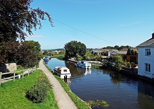
Driving past the harbour entrance and the port on the far side of the river a left turn took me to Town Quay on the riverside. With a mixture of new houses and older small commercial premises it was a long quiet road with pink pavements, pleasant roadside parking areas, colourful planters on the railings and benches overlooking the river where many fishing boats and a few pleasure craft were moored. At the harbour end of the road was a patch of rough ground with a few private garages; the pavement ended just beyond the garages and I came to a small quay and the attractive yacht harbour which I didn’t manage to photograph properly on my previous visit.
From the riverside I drove the three miles down to Harrington but this time I didn’t go anywhere near the harbour. While researching the area for a previous post a while ago I came across something on another blog which mentioned some pastel coloured houses on Rose Hill, a single sided street on the hillside overlooking the parkland and the harbour, so checking out the area on Google maps street view I thought it was worth taking a look.
The Cumbrian Coast railway line ran between Rose Hill and the parkland and the road took me under a viaduct, past the end of the harbour, back over the line via a bridge and up the hill, where there were several gravel parking areas set in the wide grass verges opposite the houses. The top end of the street narrowed into a farm track with vehicle access only to the farm and another couple of houses up there, and the steepness of the hillside meant that the railway line ran out of sight below street level so there was an uninterrupted view over the parkland, harbour and coastline.
The top two houses were large double-fronted 1950s semis while the rest of the properties were split into two long terraces of Georgian and Victorian houses and cottages, many painted in pastel colours and all well kept with small neat front gardens. It was a lovely street well worth a few photos and I was glad I’d found out about it even if it was by accident on the internet.
From Harrington I went the five and a half miles down to Whitehaven, leaving the van in Tesco’s car park and walking along the Millennium Promenade past the harbour and marina. At the far side of the harbour a flight of wide steps and a path led up the steep hillside to the Candlestick. Reputed to have been modelled on a candlestick in Whitehaven Castle, the ancestral home of the Lowther family, it was built by architect Sydney Smirke as a ventilation shaft for the Wellington Pit which was sunk in 1840 and closed in 1933. The surface buildings of the pit were also designed and built by Smirke and were in the form of a castle with a keep, turrets and crenellated walls.
On May 11th 1910 Wellington Pit became the scene of Cumbria’s worst mining disaster when 136 men and boys died following an explosion and fire deep underground. Just below the Candlestick were the remains of the surface buildings’ retaining walls and on the ground a colourful modern mosaic commemorating the mine workers, although Wellington Pit wasn’t the only Whitehaven mine to suffer fatalities. Not far from the mosaic was quite an attractive white building, Wellington Lodge, which was once the entrance lodge for Wellington pit but is now used as a coastguard base.
Although I’d been up to the Candlestick a couple of years ago I hadn’t gone any further along the hillside so anything beyond Wellington Lodge was all new to me. A tarmac lane and a footpath led from the Lodge to a residential road further up the hill and halfway along, set up above the grass, was a paved area with a modern circular seat and good views over the harbour and town. Surrounding the seat were several curved paving slabs showing the goods once imported into Whitehaven and the countries they came from.
Along the road was a building which looked very much like a ruined castle but was actually the remains of the Duke Pit Fan House built in 1836. It initially housed a steam-driven fan wheel measuring 8ft in diameter which circulated 23,000 cubic feet of air per minute through the mine workings below, but in 1870 a much larger fan wheel was installed – at 36ft in diameter it was capable of circulating 70,000 cubic feet of air per minute. Duke Pit suffered three explosions between 1842 and 1844 with the 1844 explosion killing eleven men and eleven horses. The pit closed later that same year and the shaft was then used to ventilate the nearby Wellington Pit. The fan house itself is now regarded as being the best surviving example in the country.
Just beyond the fan house the path doubled back on itself and took me lower down the hillside to a narrow flight of stone steps which led to the car park of the Beacon Museum opposite part of the marina. Heading back towards the Millennium Promenade I came to the bandstand, a modern structure with a tent-like canopy and a colourful circular mosaic floor, then along the promenade itself I found two random metal fish. I’d already seen several of these on a corner and as an art installation, if that’s what they were, they looked quite attractive but these two didn’t seem to serve any purpose except maybe as a trip hazard for someone too busy looking at their phone.
In the late afternoon sun it was a very pleasant walk along the promenade and I would have liked to sit on a bench and watch the world go by for a while but my two hours were almost up on Tesco’s car park so I had to get back to the van. Since getting back home I’ve realised that there are a couple of other places in Whitehaven which I’d like to take a look at so no doubt I’ll be making another visit during my next holiday in that area – it’s now on my list.
It was another lovely morning full of sunshine, blue sky and fluffy white clouds, with the nearby fells so clear they seemed to be within touching distance so I knew just what I was going to do with my day. Distance-wise, this time I was only driving the 11 miles to Keswick but making a photo stop on the way.
There aren’t many places on Bassenthwaite Lake where you can actually get to the water but the north west corner is one of them and it was on my route from the camp site to Keswick. Leaving the van in the first of two small parking areas set back off the lane I went down through the trees and walked along the lakeside until I could go no further without getting very wet feet. Heading south down the A66 a while later the views across the lake were so lovely that I pulled up briefly in a lay-by to get another couple of shots before continuing on to Keswick.
A couple of days before the start of the holiday a suggestion had been made via email that if I wanted (quote) “a nice fell walk that doesn’t involvemountaineering but gives stupendous views” I might like to consider Latrigg, so having checked it out on Google maps that’s where I was headed. Parking was on a residential road on the outskirts of Keswick where an unadopted lane ran for quite a distance, taking me over the A66 to the start of the footpath up the fell. An information board showed the various paths and bridleways around and up the fell and as the main path in front of me seemed to be quite steep and uneven I decided to take a level path through the woods instead.
All went well for quite a distance and it was a very pleasant walk but then I hit a big problem – a huge area of woodland extending almost to the top of the hillside had been felled and ripped out by machinery and any semblance of a footpath had completely disappeared. With nothing but piles of dried out branches and vegetation and the remains of tree trunks sticking up everywhere it looked like the aftermath of the apocalypse. So I had two choices – retrace my steps to the main path or try to find a way up the hillside. I suppose I should really have turned back but dogged determination made me continue, using the machinery tracks as a path.
The first hundred yards or so weren’t too bad but then the machinery tracks went vertically up the extremely steep hillside. To make matters worse some of them held pools of stinky, muddy stagnant water and I often had to walk along the top of the banked up earth in the centre – negotiating tree stumps and dead vegetation and trying not to let myself or the dogs slip into muddy water was certainly a challenge. I should really have taken a photo to show just how steep the hillside was but concentrating on getting up to the top without doing myself a mischief meant I wasn’t really in the mood to use the camera.
The start of my epic climb
Looking backLooking along the fell – a quarter of the way up, still a long way to go
Just over halfway up and over to my right was a barbed wire fence and a wooden gate leading to a very pleasant looking grassy part of the hillside – if I could get to it the rest of the climb might be a bit easier. There was only one thing wrong – running down the hillside in a dip between me and the gate was a stream which needed to be crossed. Carefully picking my way down into the dip I found a very narrow bit of the stream where I could step across via a couple of flat stones then up the other side of the dip I finally reached the gate.
Unfortunately it was fastened shut but that was no problem, I just posted the dogs through the bottom of it then climbed over – and what a difference there was in the terrain. A narrow but smooth and level grassy track led through an area of russet coloured bracken, the few small trees dotted about sported their autumn berries and the views to the south and east were opening up in front of me – it all looked rather lovely. It wasn’t long though before I had to start climbing again; the hillside was just as steep as before but at least the grassy track made things a bit easier.
Finally, just over an hour after I started my epic climb, I reached the top of the hillside and the gate which took me onto the ridge of the fell. It was a joy to see some reasonably flat land and after such a steep and strenuous climb I felt like I should have planted a flag there to celebrate conquering the mountain. My climb hadn’t been without incident though – several times I’d been attacked by bits of dried out tree lying on the ground and the back of my legs had sustained several scratches which still haven’t completely disappeared.
I hadn’t been on top of the fell for long when four RAF jets came out of nowhere and flew at speed one after the other right over my head. They were very loud and very low, so low that they only just skimmed the top of the fell and the earsplitting noise terrified Snowy but fortunately they were gone in seconds, disappearing out of sight up Bassenthwaite Lake.
The summit of Latrigg looking eastLooking south eastView north west towards Bassenthwaite LakeView over Keswick to Derwentwater and beyond
After spending some time taking in the views and recovering from my climb I set off on the downward journey, this time on the path that I should really have gone up. It was a fairly easy-to-walk zig-zag route which gave me some more lovely views over other nearby fells, with the last few hundred yards of the path being the steep bit which I should have gone up at the start. Eventually I was back on the unadopted lane crossing over the A66 and my last shot of the day was taken just before I reached the road where I’d left the van.
View along the Vale of Keswick to Bassenthwaite
At 1,207ft Latrigg is one of the smaller fells – I’d climbed up it, walked down it, got some good photos in the process and the dogs had a good walk, now it was time to go back to the camp site and relax for the rest of the day.
While writing this post I came across a photo on the internet which I’m including here. The screen capture from Google maps shows the hillside before the Forestry Commission got their machines on it – the blue line is where I walked through the woods, the yellow shows the area of trees which have been felled and the red is my route up the hillside. The photo shows the steepness of the hillside – although the bottom of the hill is obscured the red line shows part of my route to the top, with the white spot denoting the gate I climbed over.
Photo credit – The Keswick Reminder
Would I go up Latrigg Fell again? At the moment the jury’s out on that one but I won’t deny that the views were certainly ‘stupendous’ so if I’m on another camping holiday in Cumbria and the weather is right then maybe – although if I do I’ll make sure I use the proper path to get there.
Back in January this year I watched the second series of a crime drama shot in and around Morecambe. Most of the locations I instantly recognised from previous visits but there was a house featured in a place which I felt I knew even though I also knew I’d never been there. Some logical thought and a study of Google maps and street view eventually showed me where it was so the Saturday morning of the August bank holiday found me driving along Morecambe promenade and the coast road to arrive in Hest Bank just a couple of miles northwards.
The road to the shore was crossed by the west coast main train line and the barriers were down when I arrived so I had to wait a few minutes for the trains to pass. Just beyond the level crossing was a parking area and a small cafe, with a long and pleasant green overlooking the bay and a few more small parking areas set at intervals just off the tarmac lane. With just a couple of large semis and a very small residential static caravan site there was nothing there but it was a nice enough little place which seemed to be popular with walkers with or without dogs, while the vast expanse of sands provided good cantering for a couple of horse riders.
Walking northwards I soon found the house I’d seen in the tv series; the lane turned into a gravel track there which ended in another small parking area and a grassy foreshore above the shingle beach. I would really have liked to walk on a bit further but I could see quite a few people in the distance with several off-lead dogs, something which Snowy doesn’t like, so I turned round there and headed back the other way. Back at the van I got chatting to a couple about to set off on a bike ride along the Lancaster Canal; it seemed it was only a short distance away so I decided to leave the van where it was and go check it out.
I found the canal quite easily and my walk northwards started from Bridge 118, built in 1797, but if I’d been expecting to pass through some nice countryside I was destined to be disappointed as the canal was lined on both sides with houses and bungalows. Many of the properties on the far side had large attractive gardens reaching down to the canal side while those on the towpath side were set just below the canal bank. Long strips of well mown grass separated the boundary walls and hedges from the towpath and I got occasional views over the rooftops to the bay.
Not knowing how far I would have to go to find some countryside I gave up at Bridge 122 and set off back to where I started; I had other places to go to so I didn’t want to spend too long looking for something which could possibly still be miles away. Bridge 120 was a ground-level swing bridge which seemed to provide access to just one house set on its own and not far away was a quirky looking cottage with a not-very-straight roof and an overgrown garden. I couldn’t tell if it was lived in or empty but it intrigued me enough to take a quick photo.
My next port of call was Silverdale but knowing how to get there and actually getting there were two completely different things. What should have been a relatively easy drive from Carnforth turned into an epic all-round-the-houses, miles-out-of-my-way journey round unknown country lanes due to a closed road and diversion at a crucial point, but I got there in the end.
Now I remember going to Silverdale as part of a coach trip with my parents when I was about 9 or 10 years old and though I don’t recall going to the village itself I do remember being totally unimpressed with the coast part of it as there was absolutely nothing there, so I was hoping that after all these years it might have changed a little. It hadn’t – there was still the same rough parking area, the same row of cottages set back behind a high concrete sea wall, the same ankle-twisting rocky shoreline and vast expanse of sand. Yes, the view across the bay was good but other than that there was nothing – in less than ten minutes I had all the photos I wanted and I was back in the van.
Next on the list were Jack Scout nature reserve and Jenny Brown’s Point, a relatively short drive from the village and neither of which I’d been to before. Unfortunately I couldn’t get remotely close to either of them in the van; about halfway there I was met by the second Road Closed sign of the day so I had to find a convenient place to park on a nearby lane and walk from there.
Jack Scout is an area of low limestone cliff owned by the National Trust, with its name thought to have come from old English or Norse meaning a high point where oak trees grow. Well known for its wildlife and extensive views over Morecambe Bay the area features a partially restored 18th century lime kiln and the Giant’s Seat, a huge limestone bench. Unfortunately I didn’t get to see either of these as a notice on the gate leading into the grassland warned of cows in the area and sure enough I could see several of them mooching about among the trees and shrubs. Not wanting to put myself and the dogs at risk I decided not to go there so another few minutes walking finally got me to Jenny Brown’s Point where a couple of benches set down off the lane gave great views over the channels flowing into the bay.
No one really knows how Jenny Brown’s Point got its name. One story says she was a young maiden hopelessly scanning the distant horizon for the return of her lover, another that she was a nanny, cut off and drowned by the incoming tide while trying to rescue the two children in her care, though the more believable theory stems from the 1660s when a mother and daughter, both named Jennet Brown, lived at Dikehouse, the farm at the Point. The area has also been known as Brown’s Point (1812), Silverdale Point (1818) and Lindeth Point (1828) though Jenny Brown’s Point was in use on an 1829 estate plan and has been used by the Ordnance Survey from 1848.
One story which is certainly true is the tragic tale of the Matchless, a converted fishing boat used for taking holidaymakers on trips across Morecambe Bay during the summer months. On September 3rd 1894, carrying 33 passengers and just one skipper/crewman, the boat left Morecambe to sail to Grange-over-Sands but just off Jenny Brown’s Point it was hit by an unexpectedly sudden strong gust of wind. Within seconds it capsized, throwing people into the water where many became fatally tangled and trapped in the sails and ropes. Although other nearby pleasure boats came to the rescue only eight passengers and the skipper were saved; 25 holidaymakers including five children, the youngest only 2 years old, all perished.
A few hundred yards away from the benches the lane ended at the 18th century Brown’s Cottages where huge slabs of limestone looking almost like a slipway led down to the waterside. Nearby were the remains of what would once have been a small quay and part of a broken bridge which would have crossed the channel known as Quicksand Pool.
Just beyond the cottages was an old chimney, now Grade ll listed and believed to be the remains of a short-lived copper mining and smelting project set up in the 1780s by Robert Gibson, Lord of the Manor of Yealand. He wrongly assumed that he had the right to mine for copper on nearby land owned by the Townleys of Leighton Hall and the copper was processed in a furnace at Jenny Brown’s Point, but after several lawsuits the whole operation was abandoned in 1788; Gibson died three years later in 1791.
From Jenny Brown’s Point I walked back along the lane to the van then drove the four-and-a-bit miles round to Arnside. Normally I wouldn’t like to drive into Arnside on a bank holiday as it would be extremely busy and parking wouldn’t be easy but it was gone 5pm by the time I got there and many day visitors had already left so I was able to find a parking space near the far end of the promenade.
Arnside village is situated on the West Coast main railway line in an Area of Outstanding Natural Beauty. At one time it was actually a working port but building the viaduct across the Kent estuary in 1857 caused it to silt up, making the port no longer viable. The viaduct itself is 552 yards long with 50 piers; it was rebuilt in 1915 and is a very prominent feature of the village, being more or less the first thing to be seen when coming into Arnside past the railway station.
The pier was constructed by the Ulverston and Lancaster Railway Company in 1860, replacing an earlier wooden structure and also providing a wharf for ships after the building of the viaduct prevented them from reaching the inland port of Milnthorpe. In 1934 a storm destroyed the end section of the pier which was subsequently rebuilt by the London, Midland and Scottish Railway Company, then in 1964 Arnside Parish Council bought the pier for £100. Following a storm on the night of January 31st 1983 it was rebuilt by the Parish Council after the cost was raised by public subscription and grants, and it was officially re-opened on April 12th 1984.
Walking along the promenade I heard the sound of singing coming from upstairs in the sailing club building which was once the Customs House. A board outside said the place was open so for curiosity I popped inside; a steep wooden staircase led up from the corner of a very simply furnished room and from up above came the sound of laughter and the chink of glasses. There was nothing to say if this was a public event or a private one but I don’t like sea shanties anyway so I didn’t bother finding out.
My walk took me to the end of the pretty promenade gardens before I turned round and headed back to the van, with a quick detour up Pier Lane on the way. It was well after 6pm by then, the lane was in shade and the few small shops were closed but as I’d never been up there before it was worth a quick look.
My route homeward took me down a part of the A6 which I’d never previously been along and as I headed south I caught the brief sight of an air balloon floating somewhere above the trees. Eventually I could see it properly and with not a lot of traffic on the road I was able to pull up in a couple of places and snap a handful of shots before it disappeared behind a ridge in the fields.
It was almost 8pm when I finally arrived home, with the evening sun having stayed with me all the way back. Having set out reasonably early that morning it had been a long though very enjoyable day but now it was time to make a brew and relax for a while before the dogs needed their bedtime walk.
The penultimate day of the holiday and after some heavy overnight rain – very unexpected as the evening before had been lovely – the sunshine and blue sky were back. My first port of call that morning was Harrington, a coastal village between Whitehaven and Workington. As far as I knew there was nothing much there but it did have a small harbour with a handful of boats, and having been caught by the rain after just one photo the previous day it was worth going back for a bit of a look round.
Back in 1760 Squire Henry Curwen built a small quay at Harrington on the south side of the River Wyre (not to be confused with the River Wyre running through the Fylde area of Lancashire) though there were no ships registered to Harrington at that time, but by 1794 there were around 60 ships and trade in the village was increasing. Shipbuilding and its associated industries were established by 1800 and during the 19th century Harrington became quite an important port, exporting coal to Ireland and lime to Scotland and importing iron ore. Unfortunately by the turn of the 19th/20th century a decline in the manufacturing industry saw the harbour’s use gradually drop and the Port of Harrington eventually closed in 1928.
In 1940 the Ministry of Aircraft Production set up a hush-hush Magnesite plant at the former Harrington Ironworks site at the south side of the harbour, which was sealed off and used as a reservoir for the works. The plant extracted magnesium from seawater for use in aircraft components and incendiary bombs; it was operational until 1953 and during its time was one of only two plants in the country. Eventually the plant was dismantled and the buildings demolished and in 1966 the land was completely cleared.
Today Harrington is largely a dormitory town for employees of the shops, offices and light industry in Workington and Whitehaven and the Nuclear Decommissioning Authority (formerly British Nuclear Fuels) down the coast at Sellafield. At the height of its industrial past the town had five railway stations but now only has one, situated on the Cumbrian Coast railway line close to the harbour.
Train approaching Harrington station
The harbour itself has found a new lease of life as a mainly leisure facility with 14 moorings for boats up to 35ft and 25 moorings for boats under 20ft, plus six moorings for fishing boats up to 35ft. There’s also a sailing and fishing club based on the north side of the harbour and a slipway for ‘trailer-sailors’ to access the water. On the south side is an extensive and very pleasant parkland area where the Magnesite plant once stood and a road runs along the harbourside to a large free car park overlooking a rocky beach.
Halfway along the road is Sea Legend, a sandstone statue sculpted by Shawn Williamson and unveiled in 2000. Possibly inspired by Norse mythology, viewed from one side the figure appears to be carrying a large fish but on the other side the figure’s hand is clamped firmly in the creature’s huge teeth so maybe it was getting the better of him.
Walking round the inner harbour to the north side I came to the small beach of the outer harbour. A couple of old fishing boats and half a dozen dinghies nestled in the nearby grass and a narrow path led northwards between a pebbly rocky beach and a low grassy cliff. It wasn’t the prettiest of places along there so I didn’t walk too far before turning round and retracing my steps back to the harbour. Round the south side and past the Sea Legend sculpture my harbour walk ended where it began, in the car park overlooking the rock pools and the sea.
The next part of the day was a visit to Workington harbour at the mouth of the River Derwent, three miles or so north of Harrington. I’d been aiming to go there a couple of years previously but a wrong turn had taken me to a dead end near a wind farm premises at the far side of the port, however directions from Jayne and a previous look at Google Maps had given me a good idea of how to get there and this time I found it with no problems.
A long road took me through an area of commercial premises then a pleasant heath alongside the mouth of the river to a car park at the end of what was essentially a spit of land jutting into the sea. A concrete walkway along the nearby breakwater led to an ugly square two-storey tower surrounded by railings and a staircase; not exactly a lighthouse it did have a beacon light on its roof and it’s also one of the two recognised west coast starting points of the coast-to-coast cycle route – the other is in Whitehaven.
Next to the breakwater was an area of shingle/stony/rocky beach strewn with boulders, not the nicest of places to spend any time, so with just one photo taken I drove back along the road to where there was a lay-by next to a strange circular little building with a conical roof and a boarded-up door and window. This was built in the early 1800s as a harbour workers’ shelter – a workman would watch the tide in the estuary from the shelter and raise or lower a marker to inform seamen of the water depth. The chimney stack is apparently a more modern cosmetic addition.
Between the road and the river a tarmac path led from just beyond the lay-by and through a grassy area to a slipway and a small yacht harbour where a couple of dozen leisure craft were moored; the tide was going out and many of them were already settled on the mud. Behind the yacht harbour was a longer harbour where there would be more boats, but though there were bright blue skies out to sea dark grey clouds were gathering inland and constantly obliterating the sun. If it was going to rain I didn’t want to get caught in it so I returned to the van; I could always go back to the harbour sometime in the future.
At the far side of Workington and on the A596 coast road heading north I came to a large Asda store and petrol station so I pulled in there to get a few provisions and fill up with diesel ahead of the journey home the following day. By the time I came out the grey clouds were clearing away and the sunshine and blue sky were back so I continued northwards, and bypassing Maryport I eventually reached Allonby, the third and final stop of the day.
I first ‘discovered’ Allonby at Easter two years ago and was impressed enough to return a couple of months later. To many people it would appear to be just a quaint village strung out along the coast road but delve into its history, as I did two years ago, and you realise there’s far more to the place than you think. Parking overlooking the sea towards the south end of the village, and with views across to the hills of southern Scotland, I walked north along the footpath/cycle path to where Allonby Beck flows across the beach into the sea then walked back south, sometimes along the road and sometimes round the quaint narrow cobbled streets behind.
On the side wall of the Baywatch Hotel was a 25ft mural which had been painted last year as a tribute to Colonel Tom Moore and to raise money for NHS charities. Apparently the wall was due to be painted anyway so the work was commissioned by Peter Blake who runs the hotel and painted for free by Maryport-based artist Bethany Grey. Now while it may prove to be a bit of an attraction for visitors to the village I have to be honest and say I’m not particularly impressed with it – it’s out of proportion for one thing. There are far better Tom Moore artworks elsewhere – Akse’s mural in Manchester’s NQ is far superior to this – but if the residents of Allonby like it that’s all that matters.
At the south end of the village I crossed the road and walked along the beach for a while, something which I hadn’t done on my previous visits to Allonby, then returned to the van. With nowhere open to get anything like a decent meal – I’ve often wondered why cafes etc are closed on Mondays, don’t people eat on those days? – I went across to Twentyman’s shop and got a sandwich and can of Coke which I demolished in the van while looking at the view in front of me.
I don’t know what it is about Allonby but I’ve really fallen in love with the little place and the afternoon turned out to be so lovely that I felt reluctant to leave. I would have liked to stay to see the sunset but although it was gone 6pm that was still hours away so after one final photo taken from in front of the van I headed back ‘home’ to the camp site.
Although the dark grey clouds over Workington at lunch time had caused me to cut my harbour visit short any possible rain hadn’t materialised; the rest of the day had been lovely, and relaxing in the sunshine outside the tent on an equally lovely evening was a good end to the final full day of the holiday.
Day 8 of the holiday and I was tying in a look round The Rum Story at Whitehaven with a later visit to St. Bees just a few miles to the south. Leaving the van in Tesco’s car park close to the north end of Whitehaven’s harbour I crossed the road to the end of the pedestrianised Millennium Promenade where there was a large sculpture; known as the Whiting Shoal it was sculpted by Alan Clark in 2001 and depicts the large group of fish which, centuries ago, brought the town its very first industry. Across from the sculpture a long wall had been decorated with street art courtesy of Young Cumbria, a youth work charity for young people aged 11 to 25; I rather liked the dolphins, they looked quite cute.
Away from the harbourside and heading towards The Rum Story I saw that several large circular pebble mosaics were set down the centre of a pedestrianised shopping street. Created by Maggy Howarth of Cobblestone Designs in Lancaster they were inspired by other mosaics which had existed around Whitehaven in the past.
The first mosaic featured John Paul Jones, an 18th century Scottish-American naval captain. Born and brought up in Scotland he began his maritime career sailing out of Whitehaven at the age of 13, then after serving on board a number of merchant and slave ships he rose through the ranks to become a commander. After killing one of his mutinous crewmen with a sword during a dispute over wages he fled to North America and around 1775 joined the newly founded Continental Navy in their fight against Great Britain in the American Revolutionary War. In April 1778 he led two assaults on Whitehaven’s harbour with the intention of setting fire to the fishing fleet on the second occasion but both attacks failed, causing the Americans to retreat.
In 1999, as part of the launch of a series of Maritime Festivals, Jones was given a posthumous honorary pardon by the people of Whitehaven in the presence of Lt. Steve Lyons representing the US Naval Attache to the UK, and the US Navy were also awarded the Freedom of the Port of Whitehaven. The King George ship in the second mosaic is a representation of the Whitehaven-built ship Jones sailed on as a young third mate; it was also the slave ship whose launch was celebrated with a large enamelled goblet, one of the finest pieces of glassware from the 18th century which is now on display at the Beacon heritage centre on the harbourside.
The mosaic of the fox in front of Whitehaven castle and surrounded by running hounds is based on the best surviving original mosaic in the castle courtyard, while the mosaic with the locomotive illustrates the Crampton loco which was made at the Lowca engineering works just up the coast. The first Crampton locomotives were developed between 1845 and 1847, they had a distinctive single pair of large driving wheels and were designed with a low centre of gravity to improve stability at speed on a narrow gauge track, though the design was adopted more in the United States and Europe than in Britain.
The mosaic with what appears to be a couple of men in a hot air balloon basket actually depicts several mine workers descending a shaft at one of the nearby collieries, while the next one seems to be based on the hare coursing events which would take place on Harras Moor above the town. The dragon mosaic doesn’t seem to have any information attached to it but the last one appears to be based on the Lowther family coat of arms. Walking back along the Millennium Promenade after my visit to The Rum Story I just had time to snap a few harbourside photos before my time ran out at Tesco’s car park.
From Whitehaven I drove the four miles south to St. Bees and parked in the large car park overlooking the seafront and beach. I’d been to St. Bees twice a couple of years ago but hadn’t looked round the older part of the village so after a walk along the seafront as far as the bridge across the beck I turned inland and eventually came to the Priory Church, though having the dogs with me meant that I couldn’t go in this time.
Along the road and close to the station was Beck Edge Garden, a small but very attractive enclosed space with a statue of St. Bega and a couple of benches set in a paved area. The statue was sculpted by Colin Telfer of Maryport and was unveiled by the local Mayor on September 16th 2000, when a capsule containing a scroll listing villagers’ names was placed in the plinth by the Chairman of the Parish Council.
St. Bees seafront looking north
St. Bees Priory Church
Statue of St. Bega
Beck Edge Garden
St. Bees station
Across the level crossing I walked up the main street until I’d almost run out of civilisation then back down on the opposite side. With only one shop which was closed, a couple of pubs and a handful of B & Bs the place didn’t exactly have the ‘wow’ factor but it was nice enough and I did get some quite attractive garden photos.
Back at the van I gave the dogs a good drink then set out for my next intended port of call further back up the coast, however I’d only just got there and taken my first photo when the sky clouded over and it started to rain. It wasn’t heavy but it was just enough to make me abandon my plans and as it was late afternoon by then anyway I decided to drive straight back to the camp site; I could always return the following day if the weather proved to be nice enough.
Situated in the extensive acreage owned by the Armathwaite Hall Hotel close to the northern end of Bassenthwaite Lake the Lake District Wildlife Park is only a relatively short drive along the country lanes from the camp site so on Day 5 of my holiday I decided to go along and take a look. As wildlife parks go it’s not a big place compared to many – about 24 acres in total – but most of the enclosures and paddocks were large with wide and well laid out paths making it easy to walk round and see everything.
The meerkats were closest to the entrance so I started with those, gave the next door reptile house a miss, then wandered along various paths round the enclosures. Some of the animals weren’t easy to see or photograph as they were hiding among the various trees and vegetation in their enclosures, and try as I might I just couldn’t see the red panda which was supposedly curled up asleep on a branch. I got shots of most of the ones which interested me and which stayed still long enough, and seeing the zebras reminded me of holidays spent in South Africa – the people I stayed with referred to them as donkeys in pyjamas, something which always makes me smile.
Yellow mongooses – native to South African countries
Kookaburra – native to Australia and New Guinea
A distant shot of alpacas
Grant’s zebras – native to Eastern and Southern Africa
Dwarf zebu – a breed of domestic cattle native to India
Ring tailed lemur – native to South Madagascar
Black and white ruffed lemur – native to Madagascan mountain forests
Lar gibbon – smallest member of the ape family, native to eastern Asia
Walking towards the birds of prey aviaries my attention was caught by a loud screeching noise and I went round the corner to find two of the ugliest chicks I’ve ever seen – they had faces that only a mother could love, though they were cute in their own way and would probably grow into quite nice birds. It was the smaller of the two which was making all the noise, it was ear splitting and constant, but eventually mum appeared from somewhere with some food for them both and the screeching finally stopped.
Striated Caracara chicks – native to the Falkland Islands
Brazilian Tapirs – native to South America
Crowned Crane – native to Eastern and Southern Africa
View over one of the paddocks towards Skiddaw
The final shot was actually taken from somewhere in the middle of the park as I was walking round but I’ve saved it until last as I think it’s a really nice view. The park has birds of prey flying displays, various animal talks, picnic areas, indoor and outdoor play areas, a cafe and a gift shop, none of which I bothered with; I was a bit disappointed that some of the animals were hiding so I didn’t get to see them but I liked what I did see. For a small-ish park it was very nice so I may very well make a return visit another time.
Day 4 of my holiday started with the most glorious sunrise over the nearby fells just before 4.30am, a promising start to the day ahead. This was to be my ‘big day out’ and I left the camp site a bit earlier than usual for the drive down to Ravenglass to meet up with Jayne. We had agreed to rendezvous in the village car park and when I arrived I found she had got there just a short while ahead of me. She had reversed her campervan/mobile home into a space in an empty corner of the car park so I drove into the space on its nearside, meaning our side doors were opposite and we could sit and chat easily without being disturbed.
Jayne had previously suggested taking me for a walk, she had in mind a part of Ravenglass she suspected I hadn’t seen before – she was right – so after much chatting and drinking of cool ginger beer and coffee we set off. Through the car park and over the railway line we came to a pretty little garden set behind the signal box, then past the nearby play park and quite a distance along a lane through a pleasant wooded area we came to the ruins of a Roman Bath House.
The Roman fort of Ravenglass was established on land between the lane and the river estuary and is believed to have been occupied from AD 130 to the end of the 4th century. Standing almost 13ft high in places, the remains of the bath house are among the tallest surviving Roman structures in northern Britain. The building was identified as being Roman in the 19th century, although it was initially thought to have been a villa and wasn’t identified as a bath house until the 20th century.
Further along from the bath house the lane turned to the right and led downhill under the railway line to the estuary, where we walked along above the shore line before dropping down onto the sand for the last couple of hundred yards to the village’s main street.
Back at the car park there was much more chatting to be done until it was time for Jayne to leave but it was still only late afternoon, my car park ticket was valid for all day and I had no reason to rush back to the camp site so I decided to stay for a while longer and take myself off for a walk across the railway bridge to the other side of the river.
Back in the village I had another walk along to the end of the main street then took a path between the houses and past the end of the car park where Jayne and I had started our walk. At the far side of the railway line for the second time I dropped down onto the platform for the steam railway and came out onto the main road into the village. Down the road and under the main railway line I was then on a loop back to the car park and my final shot of the day was taken as I passed a very pretty cottage garden.
It was well after 7pm when I finally got back to the camp site, with the good weather having stayed with me all the way back. Meeting up with Jayne had been lovely, I’d had two nice walks and taken lots of photos in the process; it had been a perfect day, now it was time to make a brew and relax for the rest of the evening.
After my brief visit to the pharmacy in Cockermouth and a look round the hardware shop and heritage museum I returned to the campsite to decide on the next part of my day. The first antihistamine tablet, which I’d taken as soon as I came out of the pharmacy, was already working its magic as the swelling in my arm had gone down considerably, and the previously purchased painkillers had seen off most of the pain in my foot. Not wanting to aggravate it any more than I needed to I decided to drive out to Caldbeck and Hesket Newmarket; both places seemed to be fairly small so I shouldn’t have too much walking to do.
The villages had previously been suggested to me by my blogging friend Jayne and though I didn’t remember it at the time Caldbeck was actually featured in my ‘111 Places’ book. The village’s history can be traced back to before medieval times and since the Lake District was designated a National Park in 1951 Caldbeck, being very close to its northern boundary, is classed as being the last (or first) village within the Park. Looking at the photo in the book and reading the details it sounded like it was quite a picturesque little place so with sunshine, blue sky and fluffy white clouds I was looking forward to seeing it.
From the camp site there were two different ways to get to Caldbeck so I decided to go clockwise, one way there and the other way back. My route from the site took me onto the A595 then several miles north to the B5299 heading roughly east. The narrow road seemed to go on and on and I thought at one point my usually good sense of direction had failed me and I’d somehow taken a wrong turn somewhere but eventually I arrived at Caldbeck and a sign directed me to the village car park where I was able to leave the van in the shade of some trees.
The road to Caldbeck – not far to go
My walk started from the far end of the car park where a path led up a slope between the rear gardens of two houses and curious to know what was up there I went, coming out by an extensive village green with a large duck pond. Unfortunately I couldn’t walk all the way round the pond as the green was bisected by a couple of deep drainage gulleys with water running down them. They were only narrow but still too wide to jump across with two dogs so I had to walk quite a distance along the nearby track before I could cross the green, where I came out onto the road opposite the attractive Cornerstone Methodist Church.
Down the road and across from the car park entrance was Friar Row, a pleasant lane with a handful of detached houses on one side and stone cottages on the other. Eventually the lane turned into a track across a field and my way was barred by a field gate; it seemed to be private land from there so I retraced my steps to the bridge over the beck.
Across the bridge I skirted the rear wall of the church grounds and came out at Priest’s Mill, a restored early 18th century water mill originally built by the village rector at the time. Initially used for grinding corn, from 1933 it was used as a sawmill and joiner’s workshop until floods destroyed the mill dam in 1965. The mill was eventually restored, with the work being completed in 1985, and it now houses a couple of craft and gift shops, a cafe and a tea garden, and there’s a picnic area beside the river. The only machinery left is the 14ft diameter water wheel which has been restored to working order, and though I didn’t go inside anywhere the wheel pit area apparently displays a local collection of old rural implements.
A short walk up the track past Priest’s Mill brought me to a row of attractive cottages set sideways on to the road and a few yards along was the gate to St. Kentigern’s Church, also known as St. Mungo’s. Built on the site of a previous church dating from the 6th century the earliest parts of the current church date from the 12th and 13th centuries, with alterations made in 1512 and again in 1727 when the height of the tower was increased. In 1880 the building was restored by Carlisle architect C J Ferguson and a further restoration was carried out in 1932 by J F Martindale.
Close to the church is St. Mungo’s Well, a holy well where Christians were baptised in the 6th century, and in the churchyard is the grave of John Peel, a well known local huntsman who became the subject of the song D’ye ken JohnPeel? written by his friend John Woodcock. Also buried in the churchyard is Mary Robinson who became known as The Maid of Buttermere.
Mary was born in 1778, the daughter of the landlord of the Fish Hotel in Buttermere. At the age of 15 she caught the eye of Joseph Budworth, a soldier and writer who described her beauty in great detail in his light-hearted ramblers’ guide to the lakes and as a consequence she became quite a sensation. Five years later she married the Honourable Alexander Hope, MP for Linlithgowshire, and her wedding was reported in the London Morning Post by Wordsworth’s friend Coleridge, though several people expressed their doubts about it. It turned out that they were right and the man was an imposter by the name of John Hatfield, a forger and swindler who was already married; convicted of his crimes he was hanged a year later leaving Mary heartbroken. Her popularity had grown though and she became the subject of many theatre plays, novels and poems. She went on to marry Richard Harrison, a local farmer, and they had four children together; she died in 1837 at the age of 59.
Along the road from the church I found the village store and a row of cottages with pretty gardens, and set in a triangle between three lanes was the local pub, the Oddfellows Arms. Heading back to the car park I passed another couple of rows of cottages and some more very pretty gardens separated from the road by Gill Beck, then a hundred yards or so further on I was back at the car park.
With my circuit of Caldbeck completed I headed the mile-and-a-half along the road to the neighbouring village of Hesket Newmarket and I have to admit to being totally underwhelmed. Although there wasn’t a great lot at Caldbeck it did have several interesting features and it was a very pretty place but there was hardly anything at Hesket Newmarket. Just a pub, a small chapel and a very small shop tucked away in a corner but other than that, zilch, nada, nothing, and no pretty gardens anywhere. Its one saving grace, for me at least, was the attractive view down the village green with the fields beyond, and with just one photo taken I returned to the van.
My route back to the camp site took me back through Caldbeck and towards Bassenthwaite, passing through the hamlet of Uldale before eventually reaching the A591 where a couple of miles north I reached the turn off which would take me close to the site. I’d previously only been along that particular lane just once, on my way to the site on my first day, and I hadn’t taken much notice of the surroundings but this time I did and the views were lovely.
At one point I could see Bassenthwaite Lake, which wasn’t really all that far away, so I stopped the van in a convenient place and got out to take a couple of photos. Unfortunately no amount of editing has been able to get rid of the overhead electricity cable very visible in the zoom shot but in reality it didn’t spoil the view at all.
Thinking about my afternoon out, if Caldbeck and Hesket Newmarket hadn’t been suggested by Jayne, with Caldbeck also being featured in the ‘111 Places’ book, I would probably never have known about either of them or even gone there. Being a bit off the beaten track they certainly weren’t touristy places, in fact Hesket could best be described as ‘sleepy’, and though I wasn’t particularly impressed with the place I did like Caldbeck, so maybe some day in the future I’ll make a return visit.


 After the dog incident the rest of the walk was fine and as I headed down the long path back towards the car park I was happy to see a squirrel running along some nearby tree branches and a robin which landed in the grass not too far away. It seemed happy to stay put while I took a couple of photos then it flew up onto a nearby fence post and posed for another quick shot before flying off into the trees.


 Apart from the incident with the dog it was a very enjoyable walk and it had been good to discover parts of the terraced gardens which I hadn’t previously seen or known about. It’s a very extensive place and I know there are other paths which I haven’t yet explored so maybe next spring, once the trees get their new leaves, the three of us will go back to see what else we can find.