Southport Botanic Gardens – a walk and some history

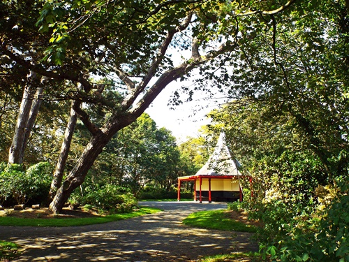
A sunny but breezy Sunday at the start of this month saw me heading out to Southport for a look round the botanical gardens in the suburban village of Churchtown on the outskirts of the town. In spite of the numerous times I’ve been to Southport over the years I’d only found out about this place recently so I was looking forward to seeing what was there.
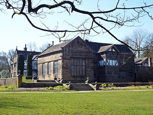
The Botanic Gardens were originally founded in 1874 by a group of local working men who formed the Southport and Churchtown Botanic Gardens Company and acquired a parcel of land from the Hesketh Estate. The company raised £18,000 to landscape the gardens, build a lake, a conservatory, tea rooms and a museum, and the gardens were officially opened in 1875 by Rev. Charles Hesketh from whom the land had been acquired, with the opening ceremony including laying a foundation stone for the museum.
The building was designed by local architects Mellor & Sutton and built by George Duxfield of Duxfield Brothers, Southport, with the famous showman, politician and businessman Phineas T Barnum being an advisor in the construction. The museum eventually opened in 1876 and Barnum donated his top hat which could later be seen on display. The running of the museum was funded by donations from the public and the local council while the gardens themselves were run as a commercial venture funded by entrance fees.
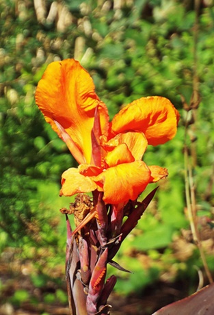
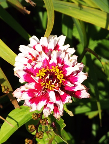
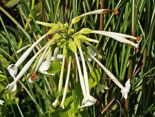
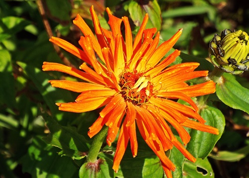
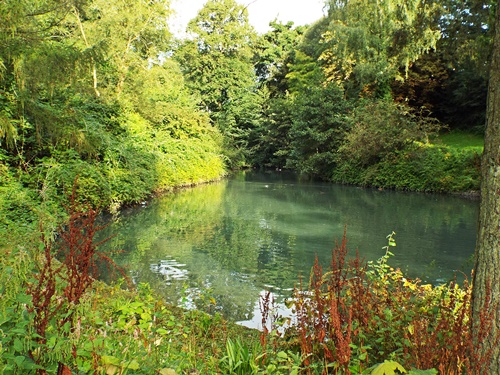
The gardens’ serpentine lake was formed from part of a stream, known as The Pool, which flowed through the grounds of the nearby Meols Hall historical manor house and out to the Ribble Estuary, and it’s said that monks who lived close by fished for eels in the stream. Attached to a magnificent glass conservatory was a fernery which proved very popular with visitors as it featured many tropical plants from around the world, and though the conservatory was eventually demolished the fernery still remains to this day.
The magnificent conservatory – photo from the internet
ferneryIn 1932 the gardens sadly closed as they were earmarked for an eventual private housing development but after a local uproar Southport Corporation intervened and bought the site with money raised by public subscription. The gardens reopened in August five years later as a public amenity renamed The Botanic Gardens and King George Playing Fields, though the name eventually reverted to the original Botanic Gardens.
All the museum’s collections were sold off when the gardens closed in 1932 but the museum was eventually reopened by John Scoles who started a new collection from scratch. A Victorian Room was constructed, many artefacts related to Southport’s heritage were donated by local residents and exhibits included the Cecily Bate Collection of Dolls, though one special exhibit, and probably the oldest item in the museum, was an ancient canoe which in recent years has been dated to 535 AD.
The canoe was found in April 1899 by a local farmer who was ploughing a field near what was once the northern shore of Martin Mere and a local historian at the time identified it as being of significant age and interest. It was first displayed in the Botanic Gardens conservatory then in 1907 it was loaned to Liverpool Museum until 1946 when it was returned to the Botanic Gardens and displayed in the museum there.
The Martin Mere ancient canoe  – photo from the internet
Fast forward through the years and in the 1980s the Friends of the Botanic Gardens Museum organization was formed. They successfully stopped the proposed closure of the museum at the time and later set up their own shop within the building; sadly it was closed permanently on April 24th 2011 as part of a cost-cutting exercise by Sefton Council and the collections were transferred to the Atkinson Museum on Lord Street where many are still on display, including the Martin Mere canoe, P T Barnum’s top hat and the Pennington taxidermy collection.
Along with the closure of the museum horticultural activities at the gardens were also significantly reduced. Sefton Council proposed further closures within the gardens which would see the loss of the fernery, aviary, garden nursery and toilets, along with the conservatory at nearby Hesketh Park. A group of local residents got together and formed the Botanic Gardens Community Association charity to save the remaining facilities at both sites, in particular at the Botanic Gardens, which along with the museum’s closure had also lost the boats on the lake, the boat house, the road train which provided a ride around the park, and the services of the park gardeners. Most of the flower beds have since been maintained by Botanic Gardens Community Association volunteers who also took over the year-round running of the fernery and the toilets, although the flower beds adjacent to the fernery are still maintained by the local council.
DSCF4580 - CopyDSCF4583 - CopyDSCF4587 - CopyDSCF4614 - CopyDSCF4612 - CopyDSCF4584 - CopyDSCF4600 - CopyDSCF4608 - CopyDSCF4601 - CopyDSCF4609 - CopyDSCF4610 - Copy
A side entrance had taken me into the park near the bowling greens and a walk through the arboretum led me to a pleasant path around the lake but when I got to the council-maintained flower beds near the fernery I felt rather disappointed. Having previously seen photos of them on the internet I’d been looking forward to a lot of bright colour but they were very pale and didn’t really live up to my expectations, however the planters and borders along the path from the main entrance were much more colourful. There was a cafe too and a rescue aviary, financed with help from the Botanic Gardens Community Association, with budgies, parrots and various other winged creatures, but the density of the mesh panels prevented me from getting any decent photos of them.
DSCF4588 - CopyDSCF4591 - CopyDSCF4592 - CopyDSCF4596 - CopyDSCF4595 - CopyDSCF4598 - CopyDSCF4593 - Copy
With my walk around the park complete, and not wanting to cut short a really nice day, I drove into Southport itself, parked up by the Marine Lake and went for a leisurely walk round King’s Gardens. Over towards the Pleasureland amusement park was what later information told me is Southport’s newest attraction, the 35-metre tall Big Wheel with an Alpine Village around its base, although everything seemed to be closed up at the time.
DSCF4615 - CopyDSCF4616 - CopyDSCF4617 - CopyDSCF4619 - CopyDSCF4625 - CopyDSCF4620 - CopyDSCF4622 - CopyDSCF4623 - Copy
Back at the car park my thoughts turned to finding a cafe for coffee and cake but I decided instead just to enjoy the drive home in the mid afternoon sunshine and have a proper meal when I got back. In spite of my disappointment over the lack of colour in some of the flower beds at the Botanic Gardens I had enjoyed exploring somewhere new – it was a lovely park which I’ll probably visit again next summer and hopefully when I do those flower beds will be a riot of colour.
** Information kindly supplied to me in February 2024 by David Cobham, Chairman of the Botanic Gardens Community Association, tells me that the gardens (excluding the council-maintained flower beds) are entered in the annual RHS Britain in Bloom awards, being judged as Outstanding for 10 years running and Exceptional for the first four years of entering the Green Flag awards, and in 2023 the BGCA volunteers were awarded a trophy for the best display bedding in the North West. Unfortunately I didn’t manage to return to the gardens in 2023 as intended but if they are good enough to consistently win awards then a revisit is definitely on the list for this coming summer.

Angel Meadow – from hell hole to tranquility

On the immediate north east side of Manchester’s city centre, off the A664 inner ring road and just a stone’s throw from Victoria Station, is Angel Meadow, a small public park occupying an area of about seven-and-a-half acres. With its open green spaces, trees and pleasant pathways it provides a lovely quiet oasis away from the hustle and bustle of the nearby city centre but it wasn’t always so nice – back in the 18th/19th century it was part of a larger area of the same name but known to many as ‘hell on earth’.
Three hundred years ago Angel Meadow was an affluent suburb of just less than one square mile, divided into three hedge-lined fields where rows of cottages were spaced out and many smart houses were built for merchants, artisans and tradesmen, but as Manchester grew larger Angel Meadow fell out of favour when those who could afford it moved further afield. By 1770 the city’s population was creeping towards 90,000, the large old merchants’ houses were let out to lodgers while builders operating without planning restrictions built poor quality houses in every available space, and in spite of the name conjuring up an image of a heavenly landscape nothing could have been further from the truth.
In 1782 Richard Arkwright’s cotton mill, the first of its kind, was built in Angel Meadow, followed by workshops, a dye works, two iron foundries and a rope works which were all opened to service the new cotton industry, and within a few years the River Irk, which ran through the area, had more mills along its banks than any other river of the same length in England. Thanks to Manchester’s new industrial age and the need to house a great many destitute Irish who had fled the Great Famine in Ireland to find work in the city Angel Meadow very quickly became run down, neglected and grossly overcrowded, and by the mid 19th century it had become one of the city’s worst slums.
Looking round the modern area today it’s hard to imagine what it was like two centuries ago with its rows of dingy back-to-back terraces and damp lodging houses which had once been elegant Georgian properties. Up to 30,000 people were packed into the dense and unsanitary slum housing where families struggling to make ends meet lived alongside criminals, gangs, vagrants and prostitutes. Homes were so cramped and dirty that new arrivals to the dingy lodging houses of Angel Meadow often had no choice but to remove their clothes to keep them free from lice, sleeping naked in rooms full of strangers where cockroaches were welcomed because they ate the bed bugs.
An attic room in a lodging house – photo from Manchester Libraries
Covered passageways led to dismal inner courtyards; backyard piggeries, slaughterhouses, bone yards, catgut factories and piles of dung released a potent cocktail of obnoxious aromas into the air and very often the alleys and back streets would be ankle deep in rotting rubbish and offal. Rickety stairs led to windowless attics where some lodgers slept on temporary beds, known as ‘shake downs’, on the floor and many people ended up living in cellars. Some of these were up to 15ft below ground level and if a home was unfortunate enough to be located next to a privy (an outside toilet) waste would frequently run down the walls. The cramped conditions, dangerously dirty dwellings and an abundance of rats led to diseases being rife, which in turn led to a high mortality rate with many of the deaths being babies and young children.
A back alley in Angel Meadow – photo from Manchester Libraries
When St. Michael and All Angels Church was built in 1788 the adjacent land was designated as a parochial burial ground, used for the interment of those who had no family place of burial or were too poor to afford a proper funeral, and the number of bodies buried there was so high it became Manchester’s largest cemetery at the time. It’s been estimated that in the 28-year period from 1788 around 40,000 bodies were interred there, all victims of sickness and extreme poverty and most buried in mass graves where coffins were piled next to and on top of each other, as many as possible until a pit was filled, then it was closed up, covered with earth and another pit dug next to it.
St. Michael’s church, Angel Meadow – photo from Manchester Libraries
The burial ground was closed in 1816 but as social and living conditions in Angel Meadow became worse over the years some of the poorer people resorted to digging up the cemetery and selling the soil as fertilizer to nearby farmers. Gravestones were removed and used to repair holes in house walls, exposed bones were collected and sold to the local glue factory, human skulls were kicked around in impromptu games of football and some slum dwellers used the cemetery as a dumping ground for ashes, offal and rotten shellfish. The situation became so bad that following a government-led investigation into the levels of squalor in the area the Burial Act of 1855 was passed requiring redundant graveyards to be covered with flagstones. This led to the burial ground becoming known as St. Michael’s Flags, and it’s this burial ground which is now Angel Meadow park.
From time to time over the years several improvements were made to St. Michael’s church including the provision of a new roof and the removal of the galleries and the three-decker pulpit, though when the Rev Jowitt Wilson was appointed rector in 1913 he arrived to find the main church door without a handle, cats and kittens in the organ and the church itself heavily in debt. Nevertheless, in his 14 years there he did tremendous work including opening the tower prayer room for daily prayer, persuading the parks committee to turn the surrounding churchyard into a garden and building a rectory. Sadly falling attendances meant the closure of St. Michael’s in 1930 and the site was sold on condition that the building was demolished, with the work finally being carried out in 1935.
The Angel Meadow area was eventually recommended for demolition under the 1930 Slum Clearance Act but it was World War Two which had the biggest impact on removing most of the slum housing – the area was heavily bombed and many homes were destroyed, though some families did continue to live there until the final slum clearances in the 1960s. Fast forward through the years since then to more recent times and the turn of the Millennium saw the regeneration of many of the old red brick factories and warehouses. The building of modern new apartments gradually brought residents back to the Angel Meadow area and St. Michael’s Flags was awarded a National Lottery Heritage grant to regenerate the neglected and overgrown space for the benefit of the new residential community.
In 2004 the Friends of Angel Meadow was formed to campaign for the continued redevelopment of the park and to research the history of the area. Over £200,000 was raised through grants and match funding, which was spent on re-landscaping the park, erecting four solar-powered street lights and an arched entrance way, installing street furniture including seating and bins, and planting trees and wildflowers, while a local heritage grant paid for the design and installation of six history boards and the publication of an information booklet. In 2006 the park was given Green Flag Award status which it has retained ever since, then in 2015 the Co-operative Group, whose newly built headquarters are nearby, funded a significant programme of work to improve the overall look of the park and rebuild its front entrance.
The Co-operative Group headquarters known as One Angel Square, close to Angel Meadow
I visited Angel Meadow in early June this year while on a quest to find a particular floral art installation which was part of the Manchester Flower Show, though I knew nothing of the park’s dark, sad secret at the time. I didn’t stay there long as I had other places to go to but in spite of nearby ongoing construction work which is part of a massive regeneration programme it was still a very quiet, peaceful and attractive place to spend some time. The surrounding modern area is now known as the Green Quarter and though the hell hole of the original Angel Meadow has long since disappeared its name lives on in the tranquility of this lovely little park.

Corporation Park, Blackburn – a spring revisit

My Monday walk this week was done just yesterday on yet another gloriously sunny blue-sky morning. Wanting to get away from walks in my immediate area but not really wanting to drive too far I decided to let the train take the strain, as the tv ad once said, and go to Blackburn to revisit Corporation Park. A reasonably early start meant there were no buses from my area down to the main station in town so a mile-and-a-half walk took me to a smaller station on the Bolton to Blackburn line. With a train due just after I got there I was in Blackburn soon after 9am and an easy walk through the town centre took me to the park situated on the outskirts about quarter of a mile away.
DSCF8367 - Copy
Approaching the main entrance
DSCF8420 - CopyDSCF8368 - CopyDSCF8370 - Copy
Halfway up the main path I took a minor path leading through the trees on the right to the larger of the two lakes then bypassing the smaller lake I headed towards the west end of the Broad Walk. Passing in front of the Conservatory I noticed its derelict condition was still as bad as when I first saw it last year, and though I stopped to look at the birds in the nearby aviary taking any decent photos of them proved difficult as there was a barrier and a great deal of narrow gauge mesh in front of them.
DSCF8374 - CopyDSCF8375 - CopyDSCF8376 - CopyDSCF8386 - Copy
The lime trees along the Broad Walk still had to gain their leaves so everywhere was much more open than on my previous visit, and though I hadn’t been impressed with the Colourfields panopticon at the time I decided to give it the benefit of the doubt and climb to the top of the park to take another look. Unfortunately my previous opinion of it was reinforced – it was dull, drab and pointless, and even though the currently leafless trees enabled a slightly better view over the town down below it was still uninspiring, so the one photo I did take from there was deleted straight away.
DSCF8388 - CopyDSCF8389 - CopyDSCF8392 - Copy
My climb to the top of the park hadn’t been in vain though. Walking along towards the east side the path was lined with creamy white daffodils and a wooded area further on was filled with both yellow and white varieties, while the pleasant open area of the children’s cycle track was in complete contrast.
DSCF8393 - CopyDSCF8394 - CopyDSCF8395 - Copy
At the far side of the park, and just outside the boundary wall, was Brantfell Road, a unique street dating from the early 20th century. Red brick terraced houses with bay windows face the eastern boundary of the park, and while the upper and lower sections of the street have vehicle access the centre section is characterised by a series of 60 wide steps which still contain the original stone setts. One website describes the street as being ‘a pram-free zone’ and having walked down the steps and back up again I can understand why.
DSCF8398 - CopyDSCF8400 - Copy
DSCF8399 - Copy
Yes, they really are so steep
Back in the park I retraced my steps past the tennis courts and the cycle track, through the wooded area and down a minor path and a set of stone steps to the centre of the Broad Walk. Another set of steps took me down to the Italian Garden but with a distinct lack of flower beds or a central water feature it couldn’t look any less Italian if it tried, though it was still a very pleasant area.
DSCF8403 - CopyDSCF8404 - CopyDSCF8405 - CopyDSCF8407 - CopyDSCF8410 - Copy
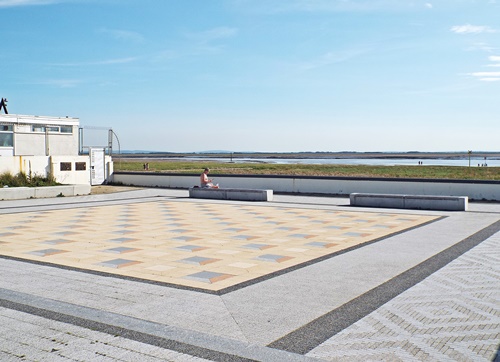
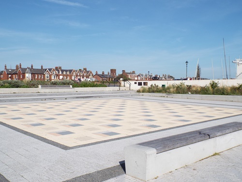
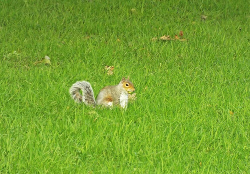
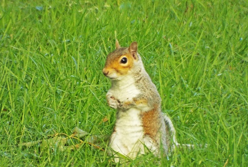
Another set of steps took me down to the extensive main lawned areas where I wandered round various paths, eventually making my way back to the bottom end of the park, then with two final shots taken just outside the main entrance I was ready to return to the station for the train home.
DSCF8412 - CopyDSCF8414 - CopyDSCF8415 - CopyDSCF8417 - CopyDSCF8419 - CopyDSCF8423 - CopyDSCF8422 - Copy
As the train approached the station where I’d started my journey I had a swift change of plan and rather than walk back home from there I decided to take the easy way out. Staying on the train to the main station at the interchange in town it was an easy matter to get a bus from there to my area and get off just round the corner from home, and though I had a five minute wait for the bus I still got back quicker than if I’d walked from the previous station.
This had been Snowy’s first experience of travelling by train and bus and though she had been a bit restless on the train out she was more settled on the return journey and was fine on the bus, so maybe on the occasions when I leave the van at home she will become quite a seasoned little traveller.

Autumn in Queen’s Park

The end of September somehow seemed to signify the end of any decent weather, locally at least, and though many October days started off with blue sky and sunshine it was almost a guarantee that by 10am the blue would have been replaced with grey clouds followed by rain. This was particularly frustrating as being at work until 9.30am meant that I missed the best part of each day, however there was a morning in the middle of the month when I wasn’t working and I was able to take advantage of the early blue sky and sunshine to have an autumn dog walk round the local Queen’s Park.
Unable to park near the main entrance as I’d done on my previous visit in August I left the van on a side road and went into the park via one of the two west entrances, following various paths to the west end of the Promenade Terrace and the steps which were halfway along.
DSCF7178 - CopyDSCF7179 - CopyDSCF7180 - CopyDSCF7190 - CopyDSCF7189 - CopyDSCF7187 - Copy
At the top of the steps was the Vantage Point Garden; just as in August it looked rather scruffy around the edges but it was still a pleasant place to sit in the sunshine for a few minutes. Wandering round to the sunken garden with its bare flower beds I found a large part of it was still in the shade so I only took one shot before retracing my steps.
DSCF7183 - CopyDSCF7184 - CopyDSCF7186 - CopyDSCF7182 - Copy
Back through the Vantage Point Garden and down the steps I walked along to the east end of the terrace and the semi-circular ‘Pie Crust’ viewing point, then down the hill past the ‘Pie Crust’ and along a path to the left I eventually came to the River Croal, Dobson Bridge and the fishing lake, still with its green surface weed, at the bottom end of the park.
DSCF7191 - CopyDSCF7192 - CopyDSCF7193 - CopyDSCF7195 - CopyDSCF7196 - CopyDSCF7201 - CopyDSCF7203 - Copy
Across Dobson Bridge I headed west past the tree with the teddy bears round its base and on towards the fountain and the nearby curving bed of red and yellow flowers. Following my previous park visit in August I found out that early in the summer the flower bed had formed the top part of a rainbow, with the rest of it and the words ‘Thank You’ painted on the grass in support of the NHS.
DSCF7205 - CopyDSCF7206 - CopyDSCF7207 - CopyDSCF7211 - CopyDSCF7208 - CopyDSCF7209 - CopyDSCF7214 - Copy
From the fountain I headed west towards the cafe then meandered up and along various paths to the big duck pond where various ducks, geese, coots and seagulls congregated; a lot of the geese and ducks came close in the hope of getting some food but unfortunately I had nothing for them.
DSCF7216 - CopyDSCF7176 - CopyDSCF7219 - CopyDSCF7220 - Copy
Following the path round and above the pond I came to a junction; right would take me back in the direction of the sunken garden so I chose left and meandered along until I came to the edge of the park and the entrance/exit which would take me back to where I’d left the van.
DSCF7177 - CopyDSCF7215 - Copy
As I drove the two-and-a-half miles back home clouds were building up and true to form half an hour later the blue sky and sunshine had gone, to be replaced by grey sky and intermittent showers, so I was rather glad that I’d taken the opportunity to do my Queen’s Park walk early in the day.

Corporation Park, Blackburn – some history and photos

Corporation Park covers an area of 44.5 acres and is situated on a very steep hill about quarter of a mile north west of Blackburn town centre. I’d never previously been there until the day last month when I went in search of the Colourfields panopticon and though I felt distinctly underwhelmed with Colourfields itself I was quite impressed with the park as a whole, so my Monday walk this week features many of the photos I took while wandering round there.
The park area was once a quarry known as Park Delph, containing large areas of millstone grit which was used for building the majority of Blackburn’s churches and cotton mills. The first steps towards establishing a park were taken in 1845 when money was raised towards the purchase of the land which was secured ten years later in 1855 by the then Mayor of Blackburn, Thomas Dugdale. Work started that same year with landscaping done by William Henderson and the building of the Triumphal Arch and its east and west gatehouses as the main entrance on the southern edge of the park.
DSCF6746 - Copy
In 1857 three of the park’s four fountains, including the largest one situated by the main entrance, were built and paid for by Mayor William Pilkington and two Russian cannons which had been captured from Sevastopol during the Crimean War and presented to the town by the then Secretary of War were mounted on a stone-faced battery at the top of the park, which is where the Colourfields panopticon is now situated.
The grand opening of the park was performed on October 22nd 1857; shops in the town were closed and factory bosses gave their employees leave to attend the event. Mayor William Pilkington led a procession from the town hall and the Sevastopol cannons were fired as part of the celebrations. An estimated 60,000 people were in attendance with 14,000 of them having arrived by train – paths were overcrowded and there were thousands of people outside the park. Four years later the park was the scene of another massive gathering when eleven brass bands performed on the upper terrace in 1861 and more than 50,000 people congregated to listen.
Although the park itself has no dedicated car parking area there’s plenty of free parking available on the roads at each side so I left the van on the east side and went back down the hill to start my walk from the main entrance. Just inside the arch and on the left was the war memorial and Garden of Remembrance, originally laid out in 1922/23 but refurbished and updated over the years. On the right of the arch was the large ornamental fountain originally powered by gravity and with a water jet shooting 75ft into the air. After being in continuous operation since 1857 it was turned off in 1905, partly due to the nuisance caused by spray drifting from the water jet and also the £30 annual cost of maintaining it and the other three fountains.
DSCF6753 - CopyDSCF6759 - CopyDSCF6758 - CopyDSCF6757 - CopyDSCF6756 - Copyfountain 3
Heading northwards up the steep main path I came to the statue of Flora, the Roman Goddess of flowers and spring. Created by Thomas Allen of Liverpool, who moved to the town in 1870, it was presented to the park by T H Fairhurst in 1871. Unfortunately the statue hasn’t survived through the years completely unscathed; in a 1952 act of vandalism the bun at the back of Flora’s head was knocked off and she sustained a chip out of one shoulder after being knocked off her pedestal, then in 1960 she was attacked with paint in a protest against apartheid in South Africa.
DSCF6762 - Copy
Close to the statue was a pretty cascade flowing down from the large lake above. Known locally as the ‘Big Can’ the lake was formed from a pre-existing reservoir created in 1772 and which served as the town’s water supply until the installation of the water mains in 1847. Just to the west was a much smaller lake with a restored fountain in the centre, and both lakes are home to several species of waterfowl including ducks, swans and moorhens. South of the lakes was an open area where a bandstand was erected in 1880; it was replaced by a larger model in 1909 but this was dismantled in 1941 and along with various gates and railings the iron was used as salvage towards the war effort.
DSCF6761 - CopyDSCF6815 - CopyDSCF6764 - CopyDSCF6765 - CopyDSCF6767 - CopyDSCF6769 - CopyDSCF6770 - Copy
From the smaller lake the path veered westwards and I emerged through a small copse to a wide expanse of lawn and the Victorian Palm House, commonly called The Conservatory, up a double flight of steps ahead of me. Supplied by W Richardson & Sons of Darlington and built of cast iron it was opened in 1902 and has a double height atrium for exotic palms and plants with a single height wing on each side for more northern fauna. With its ornate ironwork it would once have been a beautiful building but unfortunately time, neglect, bad weather, continued vandalism and council cutbacks have all taken their toll; it’s been closed to the public for quite some time and after part of the roof collapsed during a storm in 2019 it was deemed unsafe so had security fencing erected all round it.
DSCF6777 - CopyDSCF6778 - CopyDSCF6779 - CopyDSCF6781 - CopyDSCF6783 - CopyDSCF6786 - CopyDSCF6790 - CopyDSCF6788 - Copy
In 1950 a timber aviary was built close to the west side of the conservatory then in 1958 it was replaced with a better and more permanent structure. It’s still inhabited by a handful of small birds but looked rather worse for wear and was nothing to write home about so I didn’t bother taking any photos of it, then heading east past the conservatory I came to the Italian gardens with a wide path and steps leading between two lawned areas to the Broad Walk.
DSCF6796 - Copy
The Broad Walk was laid out during 1863/64 as part of park improvements undertaken by local unemployed cotton mill workers during the depression known as the Lancashire Cotton Famine. The path, which runs east to west across the width of the park, was paved with stone taken from the upper slopes and a row of lime trees (I’ve been informed there are 72 of them) was planted on the southern edge. According to the Blackburn Times newspaper in 1936 ‘crowds of young men and maidens would walk four or five abreast, promenading from end to end between 3 o’clock and 4.30 in the afternoon’.
DSCF6797 - CopyDSCF6807 - Copy
From the Broad Walk several paths and steps climb between rocky outcrops and lead up the steeply sloping land to the top level of the park where a wider path runs east to west. Along the path was the Colourfields panopticon sited on the old cannon battery which is 213m above sea level compared to the park’s main entrance at just 130m. At the east end were several tennis courts dating from the early 20th century and terraced into the hillside, with a small pavilion dating from 1921. Unfortunately they all looked rather unkempt and unused though a modern children’s cycle track situated nearby did look quite pleasant.
DSCF6802 - CopyDSCF6805 - Copy
In the 1960s a children’s play area and paddling pool were added to the park then in 1974 the park itself and its adjacent residential streets were designated a conservation area; in 1996 this was extended to the south and the park was given a Grade ll listing by English Heritage on the register of Parks and Gardens. In 1999 a Historical Restoration Management Plan was submitted to the Heritage Lottery Fund and in the years since then many improvements and refurbishments have taken place.
After eventually finding the Colourfields panopticon (and in some ways wishing I hadn’t bothered) I made my way back down through the park via various steps and pathways, taking general photos as I went and ending up back at the main entrance where a large bed of brightly coloured flowers at each side of the arch attracted several butterflies.
DSCF6787 - CopyDSCF6792 - CopyDSCF6793 - CopyDSCF6813 - CopyDSCF6814 - CopyDSCF6816 - CopyDSCF6784 - CopyDSCF6751 - CopyDSCF6748 - CopyDSCF6752 - CopyDSCF6747 - Copy
When my mum was young she lived in Blackburn and would often go to Corporation Park when she was a child; sadly she’s no longer here but I do wonder what she would think of it now compared to how it was back then. Admittedly a couple of areas do look a little shabby but on the whole it’s a lovely place so a return visit another time is definitely on my list.

Lowther Gardens, Lytham

Situated at West Beach and across the coast road from Lytham Green Lowther Gardens is the oldest park in Lytham St. Annes. Covering an area of almost 14 acres the gardens were provided by Squire John Talbot Clifton in honour of his wife Eleanor Cecily of the Lowther family in Cumbria, and also in memory of her father who died in 1868. Laid out on what was previously poor grazing land known as Hungry Moor the gardens were designed under the supervision of a Mr Tomlinson, who worked on the nearby Clifton estate, and were opened to the public on August 27th 1872.
In 1905 the gardens were given to the local council by Clifton’s son with the bowling greens being laid out the same year, and though several changes have been made throughout the years since then most of the original design and layout is still in place today. The first Lowther Pavilion was built in 1922, tennis courts were added in 1929, an aviary was constructed in 1934 and in 1936 a new main entrance and a car park were added. In 1981 the original Lowther Pavilion was replaced with the current pavilion, which is the borough’s only theatre, and in 1999 a long herbaceous border was planted to replace the rose bed near the pitch and putt area. Current features also include a crazy golf course, children’s play area and a cafe serving hot meals, light refreshments and soft drinks.
I’ve been past Lowther Gardens many times over the years on my visits to Lytham St. Annes and though I’ve often promised myself that I would stop off there and have a look round I never have – that was until three weeks ago when I was able to tie in a visit there with my quest to photograph the old boats and tractors featured in my Monday walk last week. Lowther Gardens was the nearest place to where I wanted to be so I parked there and spent quite some time wandering round before going across the road to the promenade. 
Close to the main entrance was the Lowther Pavilion where I had to get my car park ticket from but it’s not a particularly attractive building so I didn’t bother taking a photo of it. A path round the side of the pavilion took me through a wooded area where I came across what was once a bandstand in a clearing, then farther on I emerged behind one of the bowling greens.
Lowther gardens entranceDSCF6626 - CopyDSCF6628 - CopyDSCF6631 - CopyDSCF6633 - Copy
Crossing the grass to the main path I came to a rather unkempt flower bed featuring an old bike with a basket on the front and the natural ‘sculpture’ of a man sitting reading. This was ‘Between The Tides’, the recreation of a (much tidier) display celebrating the tradition of shrimp fishing on the Ribble estuary and which won Silver Gilt in the Flower Bed category at Tatton Park Flower Show in 2014. At the time Russell Wignall was the only full time ‘shrimper’ in Lytham and he can still be seen most days with his bike at Church Scar where he keeps his boat Grace, and which, coincidentally, is where I later photographed the old tractors.
DSCF6634 - CopyDSCF6636 - CopyDSCF6637 - CopyDSCF6639 - Copy
A short distance up the path and across the grass to the left was the long and wide herbaceous border with its gently curving edges rather than straight lines. Just like the Between The Tides flower bed it was rather unkempt but it was full of bright and attractive flowers with the Cobble Clock in the centre. Designed by Maggy Howarth of Cobblestone Designs, who also created the Paradise Garden mosaic in Lytham town centre, the clock was unveiled in 2005 to mark the 100th anniversary of Lowther Gardens’ status as a public park, though unfortunately it currently has no hands.
DSCF6653 - CopyDSCF6652 - CopyDSCF6645 - CopyDSCF6647 - CopyDSCF6642 - CopyDSCF6648 - Copy
Backing the border was a long box hedge with its neatly trimmed wavy lines giving shelter to the flowers and behind the hedge I came to the rose garden, a large expanse of lawn with an elevated seating area at the far side and individual circular beds each with a different colour of rose.
DSCF6654 - CopyDSCF6658 - CopyDSCF6655 - Copy
Back on the main path and in the centre of the gardens was the large Victorian lily pond with its life size bronze statue, not in the centre but towards one edge. Unveiled in November 2003 ‘Shrimper’ by sculptor Colin Spofforth was commissioned as part of a heritage lottery project for Lowther Gardens, with the history of shrimping in the area having been meticulously researched to ensure that the sculpture’s clothing and accessories stayed true to an 1880’s shrimper from the area. Swimming lazily in the pond were several large fish but the water was a bit too cloudy to get any clear shots of them.
DSCF6659 - CopyDSCF6660 - CopyDSCF6664 - CopyDSCF6663 - CopyDSCF6662 - CopyDSCF6665 - Copy
From the lily pond I headed back out of the gardens and across the road onto the green; before I went in search of the old boats and tractors there was something else I wanted to look for which I’d also seen on someone else’s blog.
Back in the early 20th century there was a prosperous fishing industry in the Ribble estuary but as the river gradually became more polluted several outbreaks of food poisoning were linked to the consumption of shellfish so to combat this three mussel cleansing tanks were constructed by Lancashire County Council and opened in 1935, operating for just over twenty years before being closed in 1957.
A restaurant was built on the site of the western tank, with the building later being used as a nightclub then as a roller skating venue but by the mid 1990s it had become derelict and vandalised so was demolished and the area paved over. The old central tank became occupied by the Ribble Cruising Club and the eastern tank by the RNLI Lytham lifeboat and its crew, then in 2017 Lytham St. Annes Civic Society sponsored the refurbishment of the paved area to retain the views and celebrate the heritage of the site.
DSCF6673 - CopyDSCF6671 - CopyDSCF6669 - Copy
With the tide having now retreated I took the opportunity to walk right down to the end of the long lifeboat jetty; it was quite a distance across the sand and thick mud and looking back to the promenade it was easy to see why the lifeboat is launched using a tractor and trailer. 
DSCF6682 - CopyDSCF6684 - Copy
With a final long distance shot of Lytham windmill and the old lifeboat station in the distance I headed back along the jetty to the promenade – it was time to go in search of the old boats and tractors back along the beach somewhere.
 

In search of Colourfields

Pennine Lancashire’s Panopticons are a unique series of twenty-first century landmarks purposely situated in high-point places which give panoramic views of the surrounding areas and after visiting the Singing Ringing Tree three weeks ago I decided to seek out another of the landmarks. Blackburn’s Corporation Park features Colourfields and as it’s an easy drive from home I went there just a couple of days ago.
The Colourfields landmark sits on the former cannon battery which was originally installed for the park’s opening in 1857 and which housed two Russian cannons captured during the Crimean War. Unfortunately time took its toll over the years and the battery fell into disrepair but the design and construction of Colourfields in 2006 enabled the structure to be preserved rather than demolished, which would otherwise have been necessary owing to its deterioration.
The large park is situated on a very steep hill to the north west of Blackburn town centre and while I realised that Colourfields would more than likely be towards the top end actually finding it wasn’t the easiest task. Numerous paths led to different parts of the park but following various signs didn’t help as they seemed to be sending me in all different directions, and I was just beginning to lose the will to live when I got chatting to a very nice couple who lived locally and were able to tell me where the landmark was and how to get to it.
Unfortunately when I did finally find Colourfields I felt distinctly underwhelmed and disappointed. There was nothing anywhere to say what it actually is, no information board, nothing, and having previously seen photos of it on the internet it was vastly different to what I expected. Any colour had disappeared almost into oblivion, there was a tile missing from one of the steps and some parts of the original coloured floor surface had been replaced at some time with ordinary plain grey tiles. The surrounding railings were nothing to write home about either, they looked just like the ones you find where you cross a road junction with traffic lights – in short, the whole thing just looked incredibly dull.
Internet information says that from the viewpoint you can see over the park down below and the town beyond, and on a clear day there are distant views towards Lytham, Southport and Fleetwood; unfortunately most of the view was obscured by trees and the sun was shining from completely the wrong direction so I didn’t take any photos from there. For the purposes of this post I’ve pinched a couple of shots from the internet just to show what Colourfields should look like but the other four photos are my own.
Colourfields 2ColourfieldsDSCF6803 - CopyDSCF6804 - Copy (2)DSCF6804 - Copy - CopyDSCF6806 - Copy
It’s a shame that Colourfields has lost its colour and is looking a bit worse for wear as it was obviously once quite attractive, but though much of the internet blurb describes it as being ‘dramatic’ and ‘impressive’ I’m afraid my own opinion of it is vastly different. On the other hand, Corporation Park itself is lovely and I got some great photos while I was there so I may very well revisit another time but one thing’s for certain – I won’t be walking all the way up to Colourfields.

Queen’s Park squirrels

Walking through Queen’s Park the other day I took several photos of the squirrel I saw, a couple of which I included in my previous post, but as he looked so cute I thought he deserved a post of his own. I actually took a photo of another squirrel when I was in the same park last year so I’ve included him too.
Copy of Local area 2019 262DSCF6194 - CopyDSCF6198 - CopyDSCF6202 - CopyDSCF6199 - CopyDSCF6196 - CopyDSCF6195 - CopyDSCF6197 - CopyDSCF6203 - CopyDSCF6204 - CopyDSCF6205 - CopyDSCF6201 - Copy
Although the squirrel I saw last year very quickly scampered up the tree the second one wasn’t in too much of a hurry so I was able to watch him from a respectable distance for several minutes. I know grey squirrels are classed as vermin but to me it doesn’t matter what colour they are, they are all cute and this one certainly was.

Early morning in Queen’s Park

Following the frequent bouts of torrential rain during last week’s storm whatever-it-was-called the weather here has been quite changeable. The mornings have started off sunny with blue skies promising nice days but by about 9am the clouds have appeared and lingered for most of the day, with the sun only returning in the late afternoons while I’ve been at work and unable to go anywhere. So when I woke to blue sky and sunshine yesterday I decided to forgo my usual leisurely Sunday morning and go out early for a walk round Queen’s Park on the edge of town, just a short drive from home and where I hadn’t been since April last year.
Being so early in the morning most of the areas near the park’s main entrance were still in shade so I went straight to where the park was more open – I could go back to those areas later on. Past the Sunken Garden and the Vantage Point Garden I came to the Promenade Terrace, a wide and pleasant walkway with statues set back in the shrubbery, benches at intervals and a viewpoint at one end; this was surrounded by a semi-circular wall which for some reason is known locally as the Pie Crust.

DSCF6129 - CopyDSCF6130 - Copy

DSCF6131 - Copy
The Pie Crust from down below

Down the hill from the terrace, and at the bottom end of the park, I came to the River Croal and a small fishing lake looking rather neglected with its surface covered in green weed. Spanning the river just there was a bridge which looked badly in need of a good coat of paint; the path at the far side split left and right with the left leading towards the town centre, however I went right and crossed back over the river via the much nicer restored and repainted Dobson Bridge.
DSCF6133 - CopyDSCF6135 - CopyDSCF6137 - CopyDSCF6139 - Copy
Up the hill from the bridge and set back off the path was a large collection of teddy bears at the base of a tree. If this was a personal memorial to someone it seemed to be a bit excessive but then I remembered – on Mother’s Day earlier this year a 7-year old little girl, innocently playing while out with her parents, had been stabbed in a random attack by an unknown woman, and in spite of all attempts to save her she died of her injuries; the teddy bears must be for her.
DSCF6143 - CopyDSCF6144 - Copy
Continuing past the tree I came to what must currently be the brightest part of the park, a long curving bed of red and yellow flowers near the wide stone steps leading back up to the Promenade Terrace. Near the bottom of the steps were a couple of benches and an ornamental fountain which would probably look nice if it was working but it wasn’t.
DSCF6150 - CopyDSCF6151 - CopyDSCF6157 - CopyDSCF6155 - CopyDSCF6156 - CopyDSCF6158 - Copy
Past the fountain was the large play area very much in the shade, then in the bottom corner of the park was the attractive stone built gatehouse with the not very attractive modern single storey cafe (which I didn’t take a photo of) situated behind it. Following a path up another hill I eventually came to the two duck ponds, and while there were a few ducks on the smaller pond most of the wildlife seemed to be congregated on the big one.
DSCF6161 - CopyDSCF6163 - CopyDSCF6165 - CopyDSCF6168 - CopyDSCF6164 - CopyDSCF6169 - CopyDSCF6170 - CopyDSCF6171 - Copy
From the big pond a path up yet another hill took me to the end of the Promenade Terrace and the steps back up to the Vantage Point Garden. An open and informal square with modern seating the garden was surrounded on three sides by low shrubs and flower borders but like several other areas of the park it seemed to be suffering from a fair amount of neglect. The fourth side was completely open and had extensive views across the rest of the park towards town although the sun was unfortunately in the wrong direction for a photo.
DSCF6175 - CopyDSCF6177 - CopyDSCF6181 - CopyDSCF6180 - CopyDSCF6183 - Copy
Heading back towards the main entrance I found that most of the sunken garden was finally in the sunshine so I was able to get a few shots there though sadly the flower beds, which should have been a riot of colour, were completely bare. Past the sunken garden my eye was caught by a movement up ahead; a squirrel had scampered down from a tree and I watched it for several minutes while it rooted about in the grass then sat there nibbling on whatever it had found for its breakfast.
DSCF6186 - CopyDSCF6187 - CopyDSCF6188 - CopyDSCF6192 - CopyDSCF6195 - CopyDSCF6202 - Copy
Once the squirrel had gone back up its tree I continued round the edge of the park to the war memorial then with the last couple of shots taken I made my way back to the van which was parked just across the road from the entrance gates.
DSCF6209 - Copy
It was only 9am when I got back home and as I made my breakfast I was glad I’d gone out when I did; clouds were beginning to gather and just like the last few days less than an hour later the sun had disappeared and the sky was grey. I didn’t mind too much though; I’d had a good walk with Poppie and got some nice photos so to misquote a popular saying – the early photographer catches the sun!


Smithills Hall and Moss Bank Park

My Monday walk this week is one I did right at the beginning of the month when most of the trees still had quite a way to go before they acquired any decent greenery. At the far side of the nearby park is Smithills Forest, part of the vast Smithills Estate owned by the Woodland Trust; being close to home it’s a good place for a dog walk in decent weather though with all the rain of the winter months I hadn’t been that way for a while.
The path from the bottom end of the local park enters the forest about halfway along the east side and the first thing I saw was what had once been a lovely old tree, now drastically cut down with all its branches lying in sections on the ground. I hate to see trees cut down but presumably it had been a victim of February’s storms and had become dangerous. Following the path alongside the stream I eventually came to the ornamental stone bridge and the path leading up to Smithills Hall’s hidden lake; in spite of all the rain over winter it was looking quite dried up in parts but I got one shot then went for a wander round the rest of the grounds.
DSCF4460 - CopyDSCF4461 - CopyDSCF4462 - CopyDSCF4463 - CopyDSCF4465 - Copy
Walking along by the outside of the Hall I noticed something I hadn’t seen before even though I’ve been there many times over the years. High up on an outside wall was a stone engraving with two initials and a partially unrecognisable date; research when I got back home told me that the initials were R B and the date was 1579. Between 1485 and 1659 Smithills Hall was owned by the Barton family and in 1579 Robert Barton rebuilt the Great Hall in stone. He also added a stone gabled west wing to the building so the initials were obviously his; it’s amazing to think that they have been there for so long.
Wandering round the grounds I came to the 1873 grave of Little Bess. Unlike my previous two visits when it had been decorated with ribbons and several pots of artificial flowers there was now just one flower in a pot, and knowing that the grave isn’t tended by anyone in an official capacity the addition or replacement of various flowers is a bit of a mystery.
DSCF4470 - CopyDSCF4471 - CopyDSCF4469 - CopyDSCF4472 - CopyDSCF4468 - CopyDSCF4467 - Copy
Leaving the Hall behind I walked along the lane past what was once Smithills Coaching House restaurant and the quaint little square gatehouse and crossed the road to a footpath running between the high hedges and fences of several residential properties. This eventually led down through a wooded area and brought me out close to the 260ft tall Barrow Bridge chimney where a short walk along the road took me to the top end of Moss Bank Park.
DSCF4486 - CopyDSCF4490 - Copy

DSCF4497 - Copy
Barrow Bridge chimney from Moss Bank Park

DSCF4499 - CopyDSCF4501 - CopyDSCF4502 - Copy
From the daffodil covered slopes at the top of the park I made my way down past the deserted play area and closed-up café to the rock garden and the walled garden. Both were closed and the gated and wire-fenced entrance to the rock garden meant that I couldn’t see anything at all from the outside, however the fancy railings set into the wall of the walled garden had plenty of spaces which allowed me to see the garden and get several uninterrupted shots.

DSCF4505 - CopyDSCF4506 - CopyDSCF4507 - CopyDSCF4509 - Copy

DSCF4510 - Copy
The bottom end of the park

Strolling through the far end of the park and across the grass took me back to the chimney and from there I retraced my steps to Smithills Hall but instead of going back through the forest I went along the lane and through the nearby yard at Smithills Open Farm. I’ve never actually been into the farm itself as I refuse to pay what I consider to be quite an expensive entrance charge, therefore I didn’t know of the existence of the llamas so I was quite surprised to see two adults and two young ones in the paddock next to the lane.
DSCF4476 - CopyDSCF4475 - CopyDSCF4474 - CopyDSCF4478 - Copy
With the final four shots taken I made my way past the farmhouse and through the local park to home, where I finished off my afternoon walk relaxing with a good mug of coffee and a slice of cake.