
Just over a week ago a morning full of blue sky and sunshine prompted me to ditch the housework and drive the 20-miles to Preston marina and old dock. It’s a place I hadn’t visited for several years and there was a part of the area which I was keen to explore.
The history of Preston Dock dates back to 1884 and though I’ve written about it previously I think it’s interesting enough to repeat it for anyone who wasn’t following my blog back then. Although Preston itself is 16 miles from the coast boats were travelling along the River Ribble to and from the city for hundreds of years. In 1825 the New Quays, later named Victoria Quays, were constructed but with the river being tidal boats could only get in and out at certain times and as ships gradually got larger the waterway became a problem.
The solution lay in the building of a large dock basin with a set of locks to control the water level and construction began in 1884. The river was moved away from its original line and four million cubic yards of soil were dug out of a 40-acre site, creating a dock basin 40ft deep, 3,000ft long and 600ft wide – it took a month to fill it before it could be used for the first time and it was the largest single dock in Europe. Such a large project required a large investment however and the initial £500,000 budget was soon exceeded, with the council needing a further equivalent amount resulting in a mortgage which would take over sixty years to pay off.
The dock was officially opened in 1892 by Queen Victoria’s son Prince Albert Edward (the future King Edward Vll) and was named after him, and the SS Lady Louise, chartered by E H Booth & Company (now better known as Booth’s supermarkets) was the first ship to unload its freight there. Only four ships used the dock in its first year but by the turn of the century that number had risen to 170 and was still increasing; the main imports were timber, china clay, coal, oil, petrol, bananas, wheat and Irish cattle. In 1936 new Art Deco style dock offices opened nearby and two years later a dock railway was added to the site.
During WW2 the dock was taken over by the military and used as a marshalling post, then in 1948 the first ever roll on/roll off ferry service was introduced, sailing to and from Larne in Northern Ireland using the SS Cedric, a former tank landing ship. Trade increased throughout the 1950s and the port was so successful that the original mortgage repayments were no longer charged on Preston residents’ rate bills. By the 1960s the port was at its peak and holding the record for handling the largest amount of container and ferry traffic, but by the early 1970s it was starting to flounder as nearly half of the income generated was being spent on dredging the river to allow access for increasingly bigger ships. Larger ships meant that fewer could use the port and trade began to fall away; the city lost many of its imports and the Larne ferry stopped running as it was unable to compete with ports such as Liverpool which could offer a faster turn-around time. Preston’s port became uneconomical and in 1979 the decision was made to redevelop the site; the dock finally closed in 1981 with a great number of job losses and a major redevelopment of the area started in 1982.
After dealing with the polluted water and land a new road infrastructure was put in place and over the next several years a huge amount of work was done. The lock gates were repositioned to stop flooding from storms, a boatyard with chandlery facilities was constructed and the original railway line which ran on the north side of the dock was removed, with a new line being laid on the south side between the river and the dock basin. A swing bridge was installed over the dock entrance for the passage of vehicles, trains, pedestrians and boats, and a new Dock Control Centre was built close to it, although industrial railway traffic eventually ceased in 1995 with the line subsequently being operated for leisure by the Ribble Steam Railway Company.
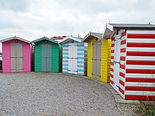
Many modern homes have been built on the strip of land between the river and the south side of the dock with the old Shed No.3 being converted into Victoria Mansions apartments, while the north side of the basin features many retail and leisure developments with Homebase, Morrison’s, Halford’s and Pets At Home now being just a few of the stores along that side. A pleasant promenade runs round three sides of the dock with the swing bridge making the fourth side, and the west end of the basin itself is home to a 350-berth marina which opened in 1987.
My walk started from the free car park overlooking the water on the north side of the dock basin and just across the road was the lighthouse situated outside the Morrison’s store. There seems to be very little information about this, with some sources saying it was built many years ago to guide ships into the dock and others saying it was only built in 1986 during the dock regeneration and the building of the supermarket, but regardless of which version is true it’s an attractive structure and worth a photo or two. Passing Halford’s, Pets At Home and the Ribble Pilot, a modern pub/restaurant established in 1992, the promenade took me round the end of the dock basin and onto the residential south side.


A distance along I came to the sign pointing between two apartment blocks to the Riverside Walk and through a small estate of modern houses with open plan gardens I crossed the access road and a level crossing over the railway line, which brought me down a grass bank and onto a wide tarmac path running between there and the river. The path forms part of the 21-mile circular Preston Guild Wheel walking/cycling route, eventually turning away from the river and crossing the west end of the dock basin via the swing bridge; I’d been that way a few years previously but this time I headed into the unknown along a rough tree lined track which continued to follow the line of the river.


It wasn’t long before I left the trees behind and the path took me onto a pleasant area of open land with a couple of benches to sit and take in the views over the river; this was the Bullnose, part of the entrance to the outer dock basin and now a popular place for fishing. Behind the huge lock gates a narrow pedestrian bridge took me across to the far side of the basin and another section of the Guild Wheel running past the back fences of a few modern houses, and set back on a corner was a huge black painted ‘thing’ which had no information but was presumably something left over from the docks and put there as a feature.


That basin is huge, isn’t it? Waterfront housing is always popular. It good that they’re trying to make something of the area, Eunice.
LikeLike
It’s really pleasant area Jo and nice for a walk without going too far from home. My previous visit there was during the winter months so it will be nice to see the place in summer.
LikeLike
I always forget how bare the trees are in a UK winter 😗🩷
LikeLike
We can swap if you like Jo, I’m always envious how beautiful all your blossom looks so early in the year 😉
LikeLike
You don’t mind if I refuse, do you? I shall soon be in Leeds for a week and I expect I’ll get a rough idea there.
LikeLiked by 1 person
I always enjoy reading about your rambles up there in the North-West Eunice, especially as I know very little about some of the places you visit, and this was no exception. I didn’t even realise that Preston had such a large dock. Now that it’s been turned into a marina it seems like a much nicer place to go for a walk than it probably would have done when it was used as a dock.
It sounded quite near to home for me as well by the way because I see that you began your walk on the north side of the dock in Mariners Way, which just happens to be the name of the road that I live in 😊
LikeLiked by 1 person
Well that’s a coincidence, especially as I think – if my memory is correct from many years ago – there’s an area called Preston not far from you. This area made a lovely walk and not too far either – I presume you followed me?
LikeLiked by 1 person
Yes, I’m afraid I was stalking you again Eunice. I like to see where prople are talking about on Google maps as you know. You’re right about there being a Preston down here as well because that’s exactly where I live, so it’s your turn to open Google Maps and find Mariners Way in Preston, Paignton 🤪
LikeLiked by 1 person
You can stalk me as much as you like Malc, I don’t mind at all, though I think you should get yourself up here and join me on a proper route march – sorry, I mean nice walk 😉🤣
I only have one question – how the heck do you get out of there when it’s several inches deep in snow and ice? It reminds me of an estate just up the road from me, built on a hill, every off-shoot has the same road name and it’s a nightmare to get out of when the weather is bad. I used to clean for my boss who lived there and if the weather was bad in winter I would walk there rather than drive.
LikeLiked by 1 person
Ice is a bigger problem than ice and it does blow a gale at times – but it’s still better than floods 🎿
LikeLiked by 1 person
Ice is a bigger problem than snow I meant to say
LikeLiked by 1 person
Proud Preston.
That building is an engine shed as you guessed.
LikeLiked by 2 people
Thanks for that BC, I thought you would probably know 🙂
LikeLiked by 1 person
I pass it regularly on The Guild Wheel.
LikeLiked by 1 person
My only experience of Preston is changing trains! I didn’t know it ever had a dock, which they seem to have made a good job of rehabilitating. Nice walk.
LikeLike
You wouldn’t want to go for a walk round Preston town centre Anabel as it’s nothing special but this area on the outskirts has been regenerated really well and is nice for a walk.
LikeLiked by 1 person
Living only 6 miles away, its about time I got to know the Guild Wheel walk and the Dock area better! Thank you for the prod in the right direction. Lesley
LikeLiked by 1 person
It’s very often the way that we don’t take much notice of what’s on our doorstep. The dock area has been regenerated really well and I like how it’s been made residential on one side and retail on the other, with the riverside walk as well. The Guild Wheel itself starts and ends in Avenham Park, can be accessed from many locations and can be walked/cycled in different sections according to personal preference – I may think of exploring a bit more later in the year.
LikeLike
Thank you for sharing the history of this place. Looks so interesting and to be a nice place for wandering.
LikeLike
There were lots of seagulls around when I was there so I almost felt like I was at the seaside, and the car park has the added bonus of a fast food van which does good cheeseburgers – I like an occasional treat when I’m out somewhere 🙂
LikeLike
Maybe the rounded end to the red brick engine shed housed a turntable for turning the engines around? Thanks for the walk. My parents used to live in Warton many years ago and I remember driving past the docks in Preston but never ventured there , it was the 80s so not as developed as now.
LikeLiked by 1 person
That’s a good point about the rounded end of the engine shed, it seems logical that there would once have been a turntable in there. This was a very enjoyable walk and one I hope to do again during the summer months.
LikeLike